Castles & Monuments
35,00 Km
2 h 19 min
I cycle often
35,00 km cycling route from La Bouille to Jumièges
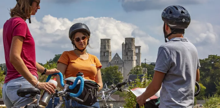
The Seine à Vélo cycle route leaves a spot so special to the Impressionists to follow the Route des Fruits, or Fruit Route. As well as admiring apple, pear, plum and cherry orchards, bearing fruit in different months, make the most of a trip into the heart of the Parc Naturel Régional des Boucles de la Seine Normande to visit local producers. Foodies might plan a special stop in the riverside town of Duclair, to taste its traditional speciality, pressed duck. If keen on history, visit the Château du Taillis, its museum dedicated to the war in Normandy in August 1944. End this stage in style, taking your bike on the ferry over to Yville-sur-Seine to reach the village of Jumièges, dominated by one of Normandy’s most remarkable medieval Benedictine abbeys. Victor Hugo described it as ‘France’s most beautiful ruin’. In this contemplative spot, enjoy a reflective pause before embarking on the last stages of the route, either heading to Le Havre along the north bank of the Seine Estuary, or to Honfleur and Deauville along the south bank.
Elevation of the stage
42 m 46 m
Waytypes of the stage
By road: 35,00 km Provisional itinerary: 13,83 km
Surface of the stage
Smooth: 35,00 km
The route
This stage of the Seine à Vélo is entirely on roads shared with motorized traffic, the speed limit varying between 50, 70 and 80 kph, depending on the area, with some stretches having traffic-calming measure in place. At the level of Bardouville, there is a very steep stretch lasting a few hundred metres.
At Yville-sur-Seine, you need to take the small ferry to reach Jumièges (the trip is free for both cyclist and bike).
Ferries across the Seine and bus services
- There are free ferry services across the Seine at La Bouille, Duclair and Yville sur Seine
- Réseau Astuce, the bus network in these parts: Line 30 (Rouen – Caudebec en Caux); line 206 (Duclair – Le Mesnil sous Jumièges); line 207 (Duclair – Jumièges); line 222 (Jumièges –Jumièges)
Don’t miss
- La Route des Fruits: This fruit route offers a complete contrast to the urban environment around Rouen! You ride past apple, pear, cherry and plum orchards, and past fields of raspberries, strawberries and red and black currants. Make the most of fruit on sale at the gate and meet local fruit farmers who have so influenced the distinctive landscapes along this part of the Seine Valley in Normandy.
- Château du Taillis: The Château du Taillis has preserved its 18th-century atmosphere, but it also contains a war museum devoted to 1944, plus it has five hectares of grounds.
- Jumièges Abbey: At Jumièges Abbey, the soaring twin towers reflect the centuries-long power of one of the most important, oldest monastic orders in the Western World. The massive abbey ruins dominate the landscape in this meander in the Seine. Even if the main church is roofless, the edifice remains an impressive example of Norman Romanesque architecture. The grounds, which include an English-style park, contain further treasures, such as the Church of St Peter, with rare vestiges dating back to Carolingian times. Much of the abbey was destroyed at the Revolution, but the ruins that remained were still staggering and rapidly became an icon of the Romantic Movement, as recognized by Victor Hugo. In this place that went on to inspire so many artists, the département (or county) of Seine-Maritime has now restored the 17th-century Abbot’s Lodgings at the entrance to the estate, creating a new cultural venue inside, dedicated to the visual arts and contemporary photography. Plus, the grounds host a biennial on environmentally-minded contemporary art.


Travellers’ reviews