Bédarieux / Béziers
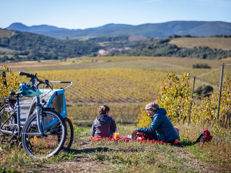
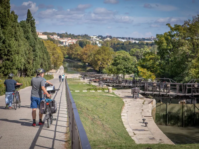
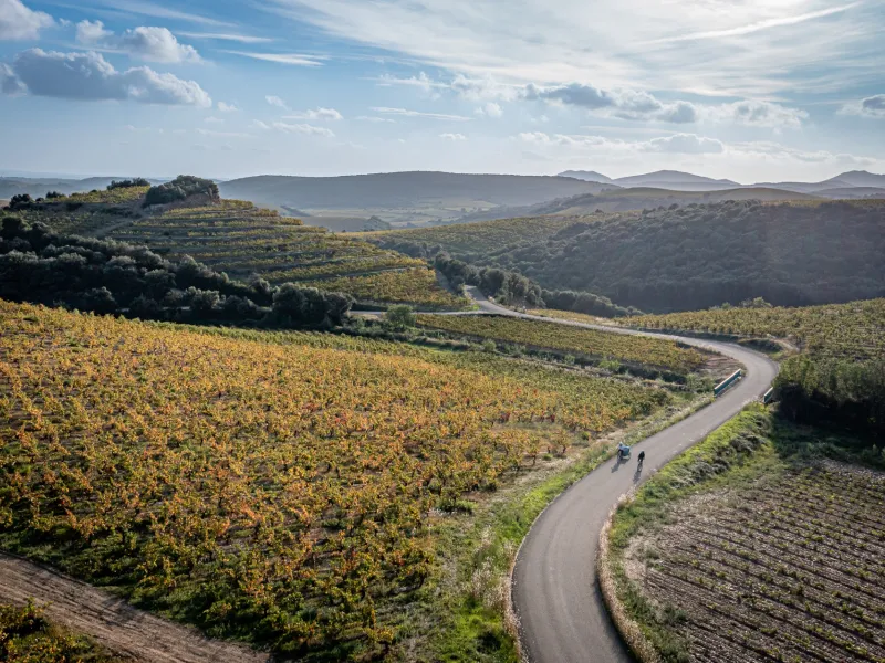
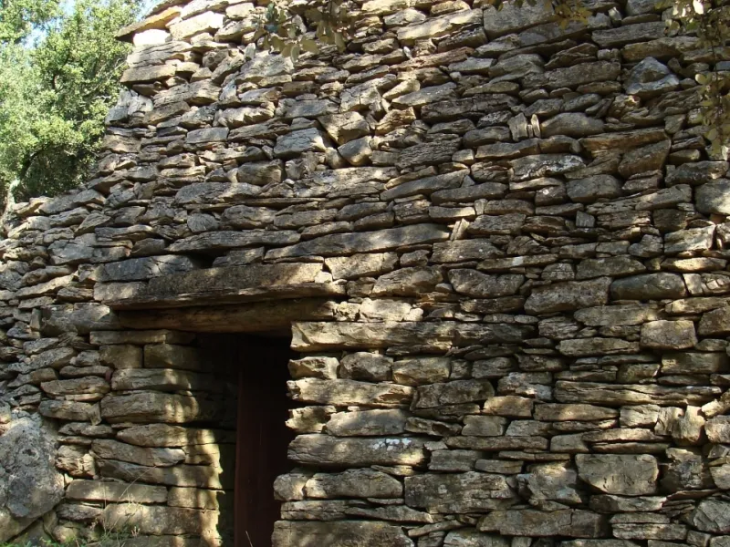
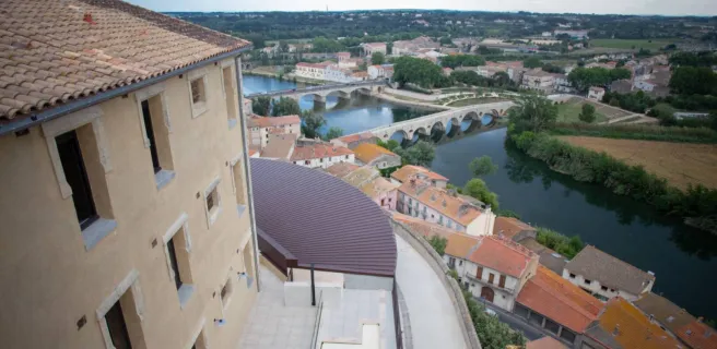
Bédarieux marks the end of the PassaPaïs Greenway. Mountainous landscapes give way to the gentler landscapes of the Avant-Monts area, vines stretching out as far as the eye can see. You may spot the sea on the horizon, a distant promise. For now, you’re entering a land rich in traditions and skills passed down the generations, while its vineyards are highly regarded today. The enchanting landscapes reflect the ingenious work carried out by farmers down the centuries, especially in the construction of dry-stone walls and capitelles (stone huts). Much older traces of civilization await a bit further on, of an ancient village inhabited first by the local Elisych tribe, then by Gauls, the oppidum of Ensérune, a pre-Roman hilltop settlement, and a star-shaped, now dried-out lake, the Etang de Montady. Moving on to the 17th century and the great engineer Pierre-Paul Riquet, his genius can be seen in the Tunnel du Malpas, dug under a hill to enable the Canal du Midi to pass through these parts, and in the monumental nine locks at Fonseranes beside Béziers. Final stop Béziers, to discover splendid bourgeois buildings reflecting flourishing commercial times and the splendid St Nazaire Cathedral, as well as following the city’s famed camel signs, indicating an historic trail and recalling the legend of a saint from Egypt, brought here thanks to the aid of his faithful animal to convert the people to Christianity.
La Véloccitanie from Bédarieux to Béziers
A mix of tracks, country roads shared with motorized traffic, greenways and towpaths. At time of writing, the link between Bédarieux and Béziers is provisional as you approach Béziers. From Puimisson, head for Murviel-lès-Béziers and Réals, then ride along the greenway St-Chinian/Maureilhan up to the Canal du Midi at Colombiers, continuing on to the nine locks at Fonseranes beside Béziers. You can then reach the centre of this city via a short signposted hiking trail with temporary signs in place for cyclists.
Links with Le Canal des 2 mers à vélo and La Méditerranée à vélo EuroVelo 8 at Béziers
Gradients and elevation
Road types
Surface
Don't miss
- Bédarieux: wander along the Orb River, climb onto the surrounding causse plateaux and even admire the glass canopy over the railway station; the Faugérois area is packed with vineyards offering wines to taste and buy, so do stop either at a cave (cellar), a domaine (wine estate), a château (a grand estate), or a mas (a traditional southern French farm) to taste the fine wines produced in the Hérault AOC area and its neighbouring area, designated the IGP Haute-Vallée de l’Orb.
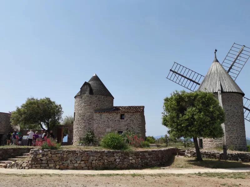
- Le Moulin de Faugères: restored in the 1990s, this windmill perched at 417m in altitude still employs the original period millstones installed by the Rivière brothers (millers here from 1829 to 1849) and the 360° panorama remains amazing. Further mills can be viewed in the vicinity, including a duo that can be freely visited at Lenthéric, a hamlet to be found by turning left from the D136 E6 towards Cabrerolles, these two mills interlinked, standing beside a stream, one a watermill, the other a windmill.
- Faugères: the site of Les Mates Basses – a three-hectare property belonging to the Parc Naturel Régional du Haut-Languedoc, reached via the GR de Pays Tour en Faugères hiking trail signposted in red and yellow and a wine shop selling Crus Faugères wines – offers an iconic presentation of the Languedoc Region’s traditional architecture in a remarkable natural setting, presenting visitors with an exceptional mix of old stone buildings, natural spaces and art, plus a refreshing walk through traditional vegetation, encouraging you to relax a bit before continuing under the strong sun that beats down on the typical scrubland of these parts, known as garrigue.