Mountains
39,38 Km
2 h 37 min
I cycle a lot
39,38 km cycling route from Colmars to La Colle St-Michel
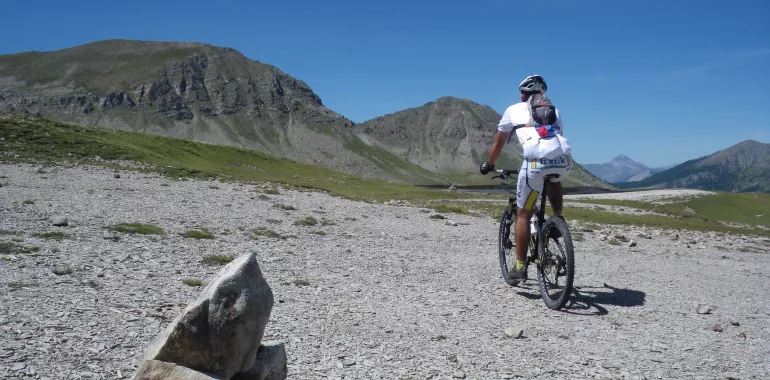
Being in top physical shape is an absolute prerequisite on this mountain-biking stage, only accessible once the snows have melted. It involves a total positive shift in altitude of 1800m, leading riders up to the highest point on the Grande Traversée, La Baisse du Détroit (2472m). The long descent to La Colle St Michel, entirely by trails, crosses high-altitude Alpine meadows and forests. This is a great treat for testing your cycling skills!
Elevation of the stage
1361 m m
The route from Colmars to La Colle St-Michel by mountain bike
Climbing, first make use of the little road towards the Col des Champs pass for some seven kilometres, up to the hairpin bend located at 1826m in altitude, then continue southwards on trails with some steep stretches. Riders will appreciate the descent to the Cabane des Juges to draw breath before tackling the ascent to the Lignin Lakes and La Baisse du Détroit. Make sure to avoid any herds along the way! The descent to La Colle is smoother and more playful, taking you along hiking paths.
Don't miss
- Colmars-les-Alpes fortified town
- Bélvédère Saint-Jean
- Lignin high-altitude lakes
- Peyresq village
Travellers’ reviews