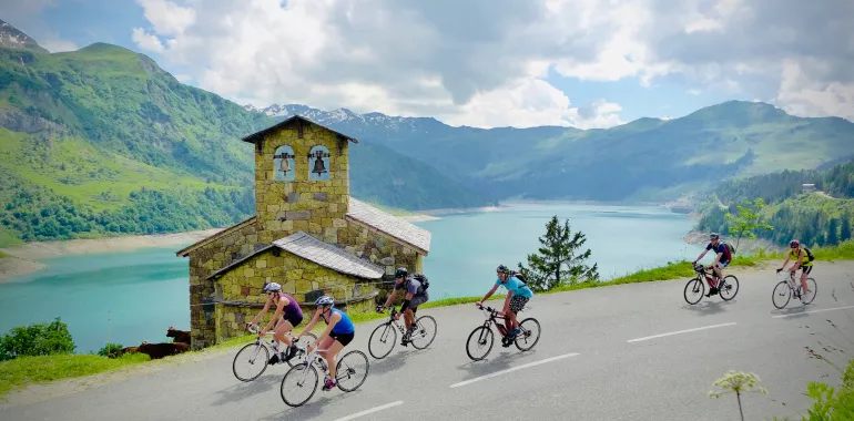
39,71 km cycling route from Beaufort-sur-Doron to Bourg-Saint-Maurice
Elevation of the stage
Waytypes of the stage
Surface of the stage
From the Beaufortain to the Tarentaise Valley via the Cormet de Roselend
Route North / South
↗ 1491m ↘ 1414m
From Beaufort-sur-Doron, the route crosses a forested area, then some hairpin bends lead to the Col de Méraillet pass (1605m), beside Roselend Lake and its dam, set in green surrounds in summer. The magnificent but harder alternative takes you via the Col du Pré (1703m) passing along the dam itself. Whichever way you choose, you haven’t reached the summit of the Cormet de Roselend (1968m) yet, as, to attain it, you need to complete a very serious climb totalling some 20km, with an average gradient of 6.5%. After this effort, the reward is an equivalent descent to Bourg-Saint-Maurice, a resort with all the amenities of a mountain town, plus a train station and bus station.
Route South / North
↗ 1414m ↘ 1491m
From Bourg-Saint-Maurice, the climb to the Cormet de Roselend (1968m) involves a major effort, with 19km to ride at an average gradient of 6%. It makes a good way to start your day! You’re amply rewarded for your effort on the other side, gliding down to Roselend Lake and its dam. From the Col de Méraillet pass (1605m) near the lake, choose from two options: the normal descent, or the alternative way via the Col du Pré (1703m) which, after you’ve crossed the dam itself, makes you climb again before descending to Arêche-Beaufort, then Beaufort-sur-Doron.
Don’t miss
- Arêches-Beaufort : Arêches combined with Beaufort, this mountainous area becomes even more magical, with iconic climbs to tackle!
- Vallon des Chapieux: with surely one of the most beautiful views along the Route des Grandes Alpes®, to be admired both climbing to and descending from the Cormet de Roselend, on the Beaufortain side.
- La Pierra Menta (2714m): its monolithic rocky summit stands out from afar; legend has it that this 120m high wall of rock ended up here when fictional giant Gargantua kicked it over from the Aravis. It’s given its name to a famous Alpine ski-mountaineering race.
- Roselend Lake: created in 1962 with the construction of Roselend Dam, considered one of the most aesthetically pleasing Alpine barrages. The lake’s turquoise waters drowned the summer farming village of Roselend, of which only the chapel of St Mary Magdalene remains.
- Bourg-Saint-Maurice Cooperative: in the town centre, opposite the station, this cooperative dairy for the Haute-Tarentaise area is very much worth a visit, dedicated to putting Beaufort cheese and the area to the fore.


Travellers’ reviews