All types of routes
Château-Gontier – Châteaubriant
Shortcut
Jeremy Jehanin 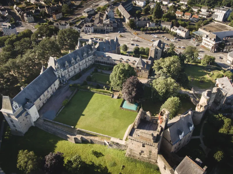
J. Damase 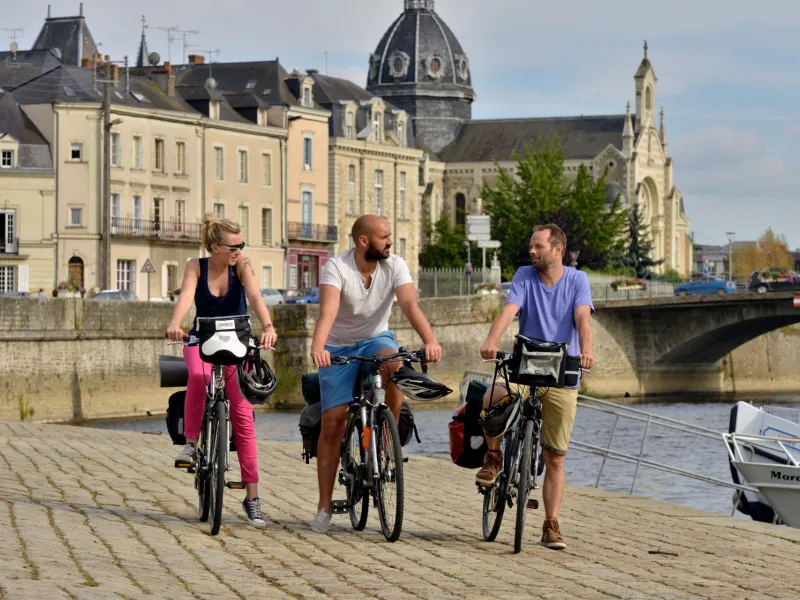
Mathieu GENON - Anjou Tourisme 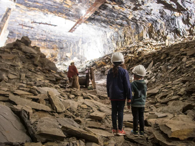
Jeremy Jehanin 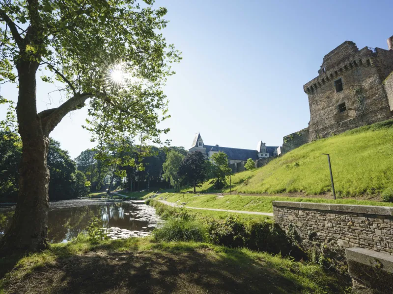
Jeremy Jehanin 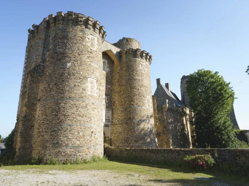
A (short) journey from the Mayenne valley to the medieval city of Châteaubriant, through bocage landscapes between Mayenne, Anjou and Loire-Atlantique. Following an old railroad line, this cycling itinerary entirely on greenways takes you past picturesque villages and small working-class towns. Halfway along, the "Mine Bleue" invites you to descend into the heart of an old slate mine. The trail then continues, punctuated by numerous medieval discoveries... It's an easy, car-free route, accessible to all!
Route signposting
The Château-Gontier–Châteaubriant route is fully signposted with green signs on a white backgroun
Gradients and elevation
Ascents: 166m
Descents: 116m
Lowest point: 21m
Highest point: 104m
Road types
64km (93%) Cycle path
5km (7%) By road
Surface
11km (16%) Smooth
38km (54%) Unknown
20km (87%) Rough
Trains and transport on the route
Access by train:
- Nearest station to the start (Château-Gontier): Laval station (35 km away, following the Vélo Francette cycle route)
- From the finish (Châteaubriant): Châteaubriant station (direct tram-train service to Nantes – 1 hour 10 minutes)
View infrastructure on the map
Reviews for Château-Gontier – Châteaubriant
"Accueil Vélo" accommodation on Château-Gontier – Châteaubriant
14 Accueil Vélo accommodations await you on Château-Gontier – Châteaubriant!
View accommodations on the map
The 3 stages of Château-Gontier – Châteaubriant
1 Château-Gontier / Segré-en-Anjou Bleu
The cycle route starts at Vieux Pont and follows La Vélo Francette to the connection with the voie verte, now equipped with directional signs to Segré. With its compacted stabilized surface, this green ribbon joins Segré-en-Anjou-bleu (Maine-et-Loire). The route offers alternating views of woods, pastures and farmland, before crossing the old railway viaduct overlooking the Oudon and the town of Segré.
2 Segré-en-Anjou Bleu / Pouancé
Mostly a greenway, built on the right-of-way of a former railroad line, this section between Segré and Pouancé runs along ridge lines, offering unobstructed views of the Anjou bleu bocage, punctuated by beautiful homes, model farms and 19th-century châteaux. Slate and iron ore extraction shafts and small working-class towns bear witness to the intense mining activity of the 19th and 20th centuries. Before continuing on to Chateaubriant and the Vilaine valley, make a stopover in Pouancé, Petite Cité de Caractère®, to discover its heritage and medieval fortress, or enjoy the shady banks of the Etang Saint-Aubin.
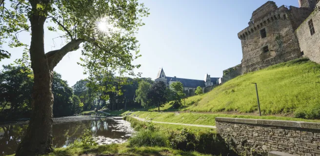
3 Pouancé / Châteaubriant
Continuing on to Châteaubriant, following in the footsteps of former railway workers, you'll discover a number of landscape windows typical of northern Loire-Atlantique, shaped over the years! From Pouancé to Châteaubriant, the route is laid out on a former railroad line.