Canals & intimate rivers
23,57 Km
1 h 36 min
I begin / Family
23,57 km cycling route from Pontailler-sur-Saône to Auxonne
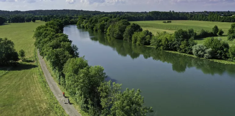
Leaving Pontailler-sur-Saône, this La Voie Bleue stage alternates between the banks of the Saône and small country roads. Enjoy a stop at Vielverge or Soissons-sur-Nacey to discover the local flora and fauna. After Flammerans, the route rejoins the banks of the Saône. Revel in the majestic arrival at the port of Auxonne, surrounded by fortifications designed by Louis XIV’s great military engineer, Vauban, and looking onto the Saône.
Elevation of the stage
31 m 34 m
Waytypes of the stage
Cycle path: 9,08 km By road: 14,49 km
Surface of the stage
Smooth: 22,56 km Unknown: 1,01 km
The route
Leaving Pontailler-sur-Saône, the route keeps beside the Saône’s towpath, but note that locals do use this track. There is a stretch on a county road between Vielverge and Flammerans (D116, then D20D) before you rejoin the Saône. Plus there’s a pebbly portion before you reach the river. The last part of this stage up to Auxonne is safe, taking you along a towpath.
Link Dijon-La Saône at the level of Lamarche-sur-Saône
SNCF (French national railways network)
TER line Dijon <> Auxonne <> Dôle
Don't miss
- Vielverge: A gravel pit has been set up for the preservation of biodiversity. A 2 kilometre long path allows you to discover the site.
- Soissons-sur-Nacey: a hiking trail is marked out with panels explaining the local fauna.
- Auxonne: Rich historical heritage : Vauban fortifications, Louis XI castle, Notre-Dame church, ...


Travellers’ reviews