Alençon / Pré-en-Pail-Saint-Samson
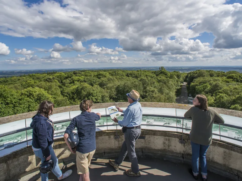
Between Alençon and Bagnoles-de-l’Orne, the Véloscénie route offers two alternatives. This one is the more family friendly of the two. From Damigny up to Pré-en-Pail-Saint-Samson, you ride along a former railway line converted into an easy, safe greenway. You’ll cross extensive unspoilt spaces, such as the Sarthon Valley and the Regional Nature Reserve around the Mont des Avaloirs. This Mount, at 416m, is the highest point of the Armorican Massif, a major geological feature of France’s northwest quarter. You can ride to this summit, the detour challenging but worth the effort for superb views from the belvedere over the bocage, the hedge-divided fields below.
Gradients and elevation
Road types
Surface
The Route
You leave Alençon via minor roads and cycle paths, but in the town centre, be careful not to get confused by signposting indicating the Le Mont St-Michel – Paris route; leaving the square in front of the town’s basilica, exit the pedestrian zone via the southwest corner and turn left at Rue du Val Noble.
After three kilometres, at Damigny, two alternative stretches of the Véloscénie go their separate ways. Cycle along the greenway up to Pré-en-Pail-Saint-Samson, the surfacing smooth, of compacted sand.
Before Saint-Denis-sur-Sarthon (7km after Damigny, riding along the greenway), follow the singposting and turn right to reach the village via quiet minor roads. Note that it is forbidden to cross the N12 here.
Follow the greenway along the last 14 kilometres of this stage up to Pré-en-Pail-Saint-Samson or take the detour to see the Mont des Avaloirs.
Tourisme offices
- Tourist Office of Alençon : 02 33 80 66 33
- Tourist Office from Mont des Avaloirs : 02 43 03 78 88
SNCF Train Services
Station close by: Alençon Train Station
À ne pas manquer
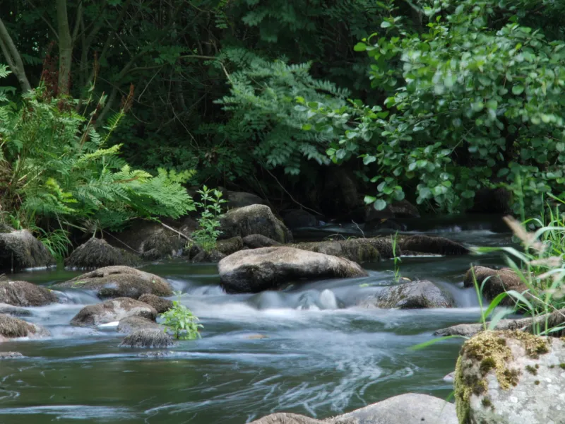
- The Sarthon River and its tributaries, meandering according to the slopes in this hilly terrain.
- The Mont des Avaloirs, the highest point, at 416m, in France’s greater northwest quarter (known as the Grand Ouest), is part of a listed nature reserve and offers wonderful views over typical bocage landscapes, divided up by hedges. It’s said that on really clear days it’s possible to make out the form of the Mont Saint-Michel... To reach the summit, leave the greenway soon after the tunnel at the level of the parish of Lalacelle; the climb is regular – 130m of positive ascent over a 3km stretch.
Trains and transport on the route
- Gare d'Alençon (prudence sur la liaison avec la traversée de la D112)