23,04 Km
1 h 32 min
I cycle often
23,04 km cycling route from Mûr-de-Bretagne to Pontivy
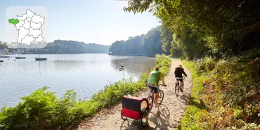
Designated track and very steep descent into the Guerlédan dam towards Pontivy. Here the Blavet is no longer navigable. The steep-sided valley, imposing lock keepers’ buildings and lush vegetation, give this stage of La Vélodyssée an enchanting feel.
Elevation of the stage
159 m 54 m
Waytypes of the stage
Cycle path: 20,93 km By road: 2,11 km
Surface of the stage
Smooth: 3,39 km Rough: 18,99 km Unpaved: 0,65 km
Itinerary
Steep descent to reach the Guerlédan dam in the centre of Mûr-de-Bretagne. After the descent there is a stage with designated track on the towpath as far as the îlot des Récollets.
Connections
On small lanes to St-Aignan and Neuillac.
Accommodation on the stage
Did you like this?
You may also be interested in this...


Travellers’ reviews