All types of routes

La Durance à vélo

Official route
Cédric Tempier
Belvédère à Saint-Appolinaire - La Durance à vélo
Cédric Tempier
Pont sur la Durance - Balade à vélo
Cédric Tempier
Vue aérienne de la Durance
Alpesphotographies.com - ADDET 05
Pause au plan d'eau d'Embrun
Cédric Tempier
Panorama sur la Durance à vélo
Cédric Tempier
Route de montagne sur La Durance à vélo
Cédric Tempier
Durance à vélo - Canal EDF
One way
170 km
1 week or more
I cycle a lot
Mônetier-les-bains
Sisteron
Mountains
Canals & intimate rivers

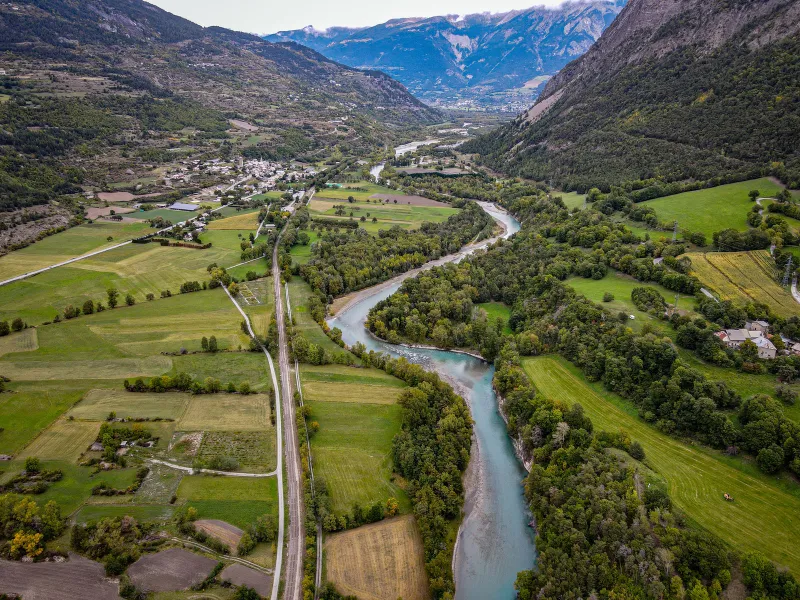
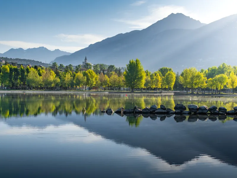
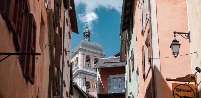
Between Briançon and Sisteron, La Durance à Vélo provides a magnificent cycle route, almost 200km in length. It leads you right across the département (French county) of Hautes-Alpes, offering a mix of Alpine slopes, perched roads and Mediterranean plains. Linking Briançon’s staggering fortifications, designed by Vauban and perched at over 1,300m in altitude, to the citadel at Sisteron, known as the gateway to Provence, the Durance River serves as the cyclist’s companion along this route. The way proves delightfully varied, with perched villages, turquoise lakes, extensive orchards and remarkable heritage sites to admire. Riding south, the mountains become gentler at each turn as you approach the perfumed air of Provence.

Signposting and the state of the cycle route

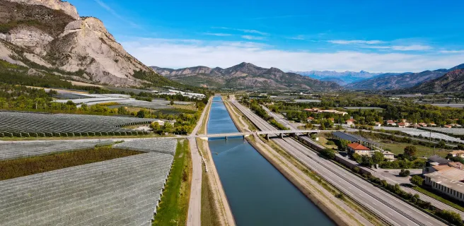
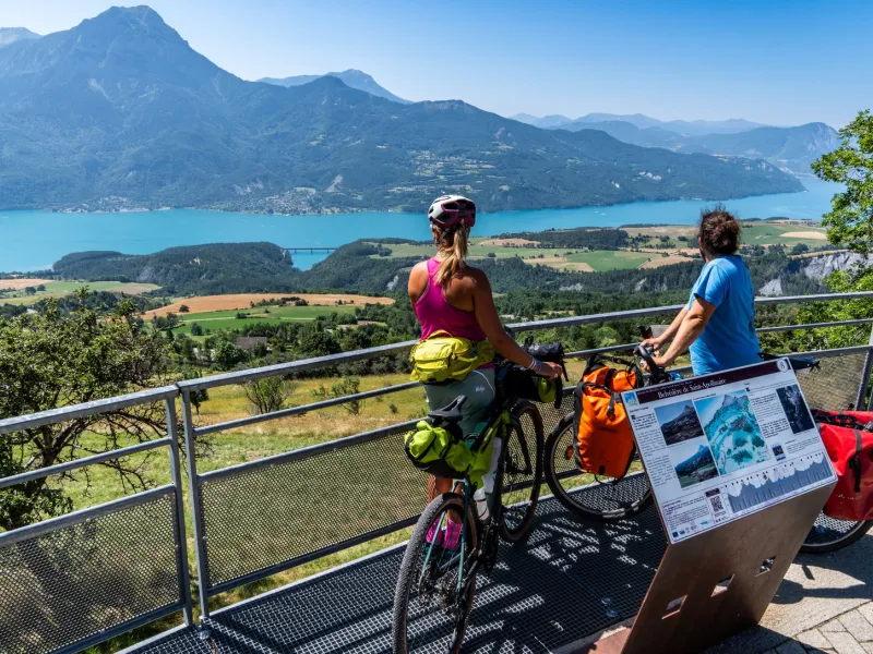
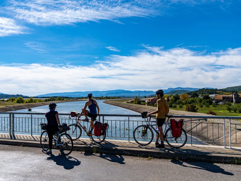
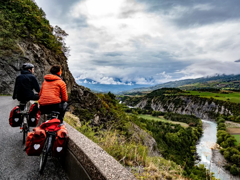
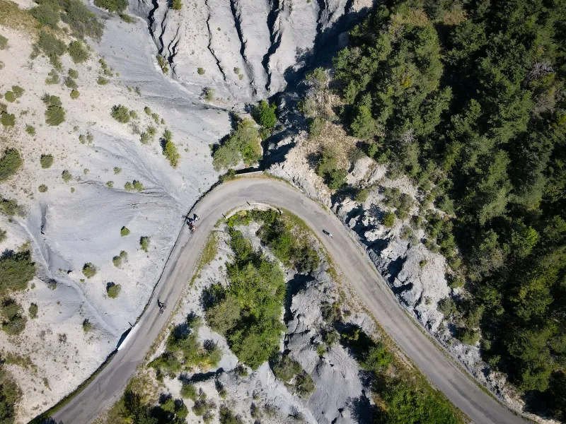
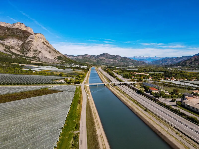
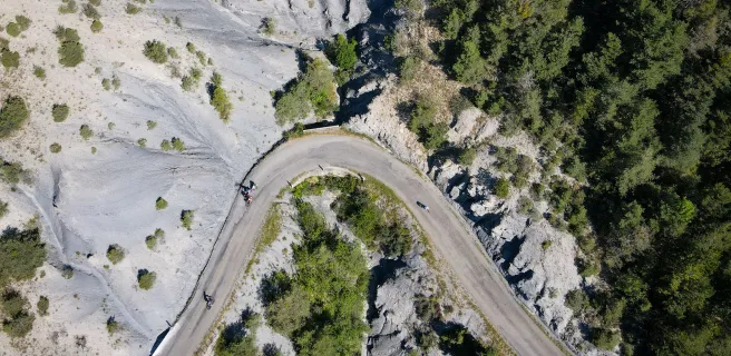
For most of the way, this cycle route leads riders along quiet little roads. Some of these may be challenging, but they’re invariably spectacular, for example those running through the Durance Gorges, or guiding you far above dramatic Serre-Ponçon Lake via the iconic Route des Puys, or taking you meandering beside the EDF Canal, with fields and orchards to either side.

La Durance à Vélo is completely waymarked in both directions, both north and south, between Briançon and Sisteron, the dedicated signposting indicating the cycle route’s name. As this route sticks mainly to secondary roads shared with motorized vehicles, take special care during the busiest holiday period, in July and August, when there can be heavy traffic at times.

Weather and seasonal variations

Conditions along La Durance à Vélo are generally pretty good for cyclists between May and October. The region is normally sunny from spring onwards. Note that temperatures can be chilly starting out from Briançon, a town perched high in the French Alps, while the southern reaches towards Sisteron, where you cycle along the bottom of the Durance Valley, can get very hot in summer. Always carry plenty of water and protect yourself from the sun. There are certain exposed climbs along the cycle route, such as that along the Route des Puys, which can prove particularly challenging in very hot weather, while the stretches alongside the EDF Canal and through the agricultural areas towards the south offer very little shade

Gradients and elevation

Ascents: 2144m
Descents: 2876m
Lowest point: 463m
Highest point: 1281m

Road types

164km (96%) By road
7km (4%) Cycle path

Surface

11km (6%) Smooth
160km (94%) Unknown

Trains et transport sur La Durance à vélo

There are seven train stations dotted along this route (at Sisteron, Gap, Chorges, Embrun, Montdauphin Guillestre, L’Argentière les Écrins and Briançon), served by three regional TER train lines (Briançon – Marseille; Briançon – Grenoble; and Briançon – Valence), plus the sleeper, or night train, Paris – Briançon, all affording cyclists easy access to different points along the cycle route.

Access by train:

  • To reach the starting point (Briançon): Briançon station
  • From the finish (Sisteron): Sisteron station

"Accueil Vélo" accommodation on La Durance à vélo

33 Accueil Vélo accommodations await you on La Durance à vélo!

The 5 stages of La Durance à vélo

Briançon / L'Argentière-la-Bessée

1 Briançon / L'Argentière-la-Bessée

21 km
1 h 25 min
I cycle often
The dramatic town of Briançon and its Vauban Citadel, perched at over 1,300m in altitude, cry out to be explored before you set off on your cycling adventure. In the immediate Briançonnais area, there are several strategic forts on the surrounding heights, signalling the historical importance of the area, that you can reach quite easily by foot. After exploring the area, it’s time to get on your bike! Heading south, the Durance River, your companion for this whole cycling trip, makes its presence felt, notably via the impressive gorges it has carved out down the millennia. Riding along, you’ll follow its rapids and cross its waters, rewarded with splendid panoramic views. Once you reach Les Vigneaux, you’ll have tackled this stage’s climbs, so enjoy the well-deserved descent beside the Gyronde, a wild torrent guiding you down to L’Argentière.
L'Argentière-la-Bessée / Embrun

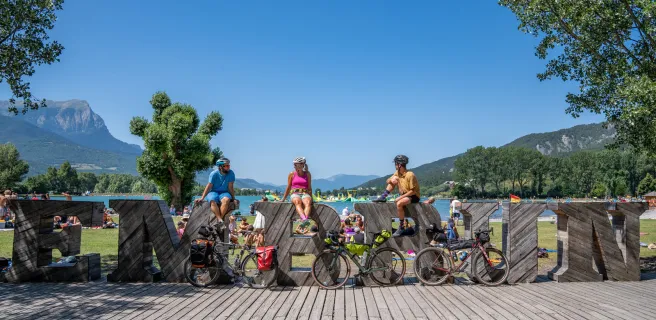
2 L'Argentière-la-Bessée / Embrun

41 km
2 h 42 min
I cycle a lot
After L'Argentière la Bessée, launch yourself on a physically demanding stretch, the Montée de Pallon. Turning back isn’t an option! This may be a very demanding climb, but it takes you high above the Durance, enabling you, through sheer effort, to discover the Biaysse Valley and the wild foothills of the Parc National des Écrins. Riding below snowy peaks, mountain streams and pines line the road on your beautiful descent to Mont-Dauphin, a fort perched at the entrance to the Queyras area. Next, the small town of Guillestre offers a jolly place for a stop, built beside lively waters. Continue alongside the Durance to the little city of Embrun, following the river’s meanders, passing hot springs, enjoying the final slopes, Serre-Ponçon Lake coming into view at the end of the stage, with the Pic de Morgon providing the mountain backdrop.
Embrun / Chorges

3 Embrun / Chorges

26 km
1 h 43 min
I cycle a lot
Leaving Embrun and the banks of Serre-Ponçon Lake behind, a long steady climb takes you along the Route des Puys, to parts that seems lost in time, they’re so remote and quiet. You wend your way along the mountainside between Alpine pastures and spectacular viewing points down on the sparkling Serre-Ponçon Lake. In the usually crisp light, with each turn, a new panorama opens up, towards the peaks of the Morgon Mountain, or the Parpaillon Range, or the great geological folds of the Réallon. Having tackled this stage’s first steep stretches, the rest of the way proves less demanding. Cycling is pleasant through the wild Réallon Valley, then comes a heady descent to Chorges, a little town set below dramatic peaks and rocks sculpted by nature into curious shapes.
Chorges / Gap / Tallard

4 Chorges / Gap / Tallard

36 km
2 h 22 min
I cycle often
This stage may be less spectacular than the more northerly ones, but it presents an enjoyably wide variety of landscapes. Riding through the Avance Valley, you pass peaceful meadows and herds as well as farming hamlets. Away from any bustle, meander along country lanes, with, as backdrop to this bucolic setting, the peaks of Le Champsaur and the Pic de Bure. The little city of Gap, surrounded by such grand summits as Céüse and Charance, provides a lovely urban stop, with its historic centre, lively café and restaurant terraces and facilities for cyclists. Leaving town, tackle this stage’s final climb to Châteauvieux before racing down to the Château de Tallard and the Durance River, enjoying the hint of Provence in the air!
Tallard / Sisteron

5 Tallard / Sisteron

48 km
3 h 10 min
I cycle often
From Tallard, you accompany the Durance, no longer the impetuous river it once was since the Serre-Ponçon Dam’s construction in 1959, water from the river being syphoned off into the Canal EDF, which acts as the guiding thread for cyclists on this stage. Orchards thrive on either side, while the Monges Range makes a charming backdrop. Around here, the Durance Valley opens out and the landscapes become gentler, but perched villages such as Upaix mark the way, with fruit trees and gypsum outcrops to the sides. The cycle route then rises above the Buëch River to offer cyclists a splendid finale, in the form of your arrival at Sisteron, a town overseen by a stone citadel built on dramatically twisted strata of rocks. Northerly lavender fields indicate that you’re reaching the border with Provence. Before cycling into this southerly region, savour the Alpine features visible in Sisteron’s very geology before heading into the sun-drenched south.
Details