8 stages · 274 km

Gradients and elevation

Ascents: 588m
Descents: 941m
Lowest point: 109m
Highest point: 515m

Road types

122km (45%) By road
145km (53%) Cycle path
8km (6%) Unknown

Surface

20km (142%) Smooth
8km (58%) Unknown

8 stages used

La Balme-de-Sillingy / Annecy

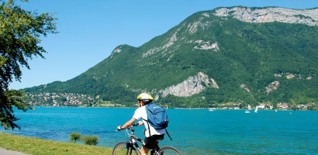
1 La Balme-de-Sillingy / Annecy

14 km
2 h 43 min
I cycle often
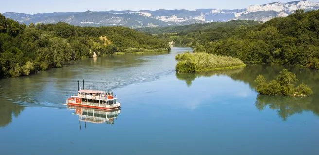
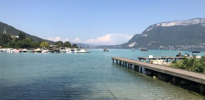
In the département (or county) of Haute-Savoie, La Belle Via cycle route (V62) will, once complete, start in Seyssel, a town straddling both banks of the Upper Rhône, and will also link up with the ViaRhôna cycle route. It will then lead to La Balme-de-Sillingy, at time of writing our recommended starting point to head off to Annecy, an enchanting historic town crisscrossed by canals.
Annecy  / Albertville

2 Annecy  / Albertville

44 km
3 h 02 min
I cycle often
After visiting the historic heart of Annecy with its cobbled streets and meandering canals reflecting pastel-coloured houses, head towards the great Lac d’Annecy to cycle off on the next stage of our cycle route guiding you through the heart of the Alps. La Belle Via leads you along the exceptionally scenic greenway running beside Annecy’s lake, taking you via the villages and beaches of the lake’s west bank. It follows the track of a former steam railway line, going as far as Les Sources du Lac d’Annecy and the Réserve Naturelle du Bout du Lac at the lake’s southern end, before leading you in the direction of the little town of Ugine and the Pays d’Albertville area.
Albertville / Montmélian

3 Albertville / Montmélian

41 km
2 h 45 min
I cycle often
Your cycling adventure continues as you ride along the foot of the southern slopes of the Parc Naturel Régional du Massif des Bauges – also designated a UNESCO World Geopark. This stage of La Belle Via leads you into the midst of the vineyards of Cœur de Savoie, recognized as a Vignobles et Découvertes area in recognition of its many wine addresses welcoming visitors. Going from one village to the next, you ride from Saint-Jean-de-Porte to Montmélian. Along the way, the lakes of Grésy-sur-Isère and Carouge are excellent for bathing, providing refreshing, relaxing stops with views of the surrounding mountain ranges, the Pointe de l’Arcalod culminating at 2,217m in altitude, Le Grand Mont d'Arêches at 2,686m.
Montmélian / La Terrasse

4 Montmélian / La Terrasse

24 km
3 h 43 min
I cycle often
La Belle Via continues towards Les Marches and Saint-André Lake, leading you through the vineyards of the Cœur de Savoie area. Do plan a little detour to visit the Musée de la Vigne et du Vin, a wine museum in Montmélian. From here, views of the Grésivaudan Valley open up, the magnificent summits of the Belledonne and Chartreuse Ranges rising to either side. This portion of the cycle route evokes the times when this valley marked the frontier between the mighty duchy of Savoy and the powerful former province of Dauphiné, its strategic importance indicated by the likes of Fort Barraux and the Château du Touvet. Reaching La Terrasse, cyclists might enjoy a stop at the outdoor leisure centre with its own campsite. Carrying on by bike, continue enjoying breathtaking mountain views up to your arrival at the city of Grenoble.
La Terrasse / Grenoble

5 La Terrasse / Grenoble

32 km
2 h 37 min
I begin
This stage of La Belle Via cycle route leads you across the Marais de Montfort, wetlands where dragonflies, butterflies and wild orchids thrive in a lively bucolic corner. Leaving the marshlands, enjoy the stunning views of the Belledonne, Chartreuse and Vercors Ranges. Next, focus on your arrival in Grenoble by bike. The city is dominated by the Fort de la Bastille, with a cable car straddling the Isère River taking visitors up to its heights. Well-known for having hosted the 1968 Winter Olympics, most of Grenoble in fact lies on the flat, so the place proves eminently suitable for cyclists, especially given the impressive network of cycle paths around town, making it a great place to explore at gentle pace.
Grenoble / Vinay

6 Grenoble / Vinay

39 km
3 h 15 min
I begin
Grenoble, a city surrounded by the great mountain ranges of the Belledonne, Chartreuse, Oisans and Vercors, offers a wonderful quality of life, plus all sorts of possibilities for exhilarating outdoor activities in different seasons. Leaving town by bike, you follow a peaceful, shaded greenway taking you through unspoilt parts, with impressive views of the Isère River and rocky cliffs rising far above it. As you ride along the wooded levées alongside the Isère, you can see islands where many species of birds nest. Plus, there’s a culinary reward for cyclists, as you continue through the largest walnut groves in Europe. Le Grand Séchoir, a museum dedicated to walnuts, is where this stage ends, a perfect spot to fill up on the local omega-3-rich nuts, available in all manner of forms.
Vinay / Romans-sur-Isère

7 Vinay / Romans-sur-Isère

49 km
2 h 03 min
I cycle often
You cycle into the hilly area of Saint-Marcellin, which has given its name to a reputed Dauphiné cow’s milk cheese, a portion of which could top up your energy on your stops! Head to Saint-Romans on the south bank of the Isère and enjoy a little detour via the medieval village of Beauvoir-en-Royans, visiting the calm site of the Couvent des Carmes. Ride on westwards to La Sône, a village renowned for its remarkable Jardin des Fontaines Pétrifiantes. Then continue through walnut groves and orchards and past dams to Saint-Hilaire-du-Rosier. Just before arriving here, you cross the Isère River, entering the département (French county) of Drôme. Carry on up to Romans-sur-Isère, a town now known as a centre for the rebirth of textiles and shoes Made in France. If keen on architecture, Romans-sur-Isère has a rich heritage, presenting a mix of Romanesque and Gothic craft… as well as industrial-era pieces.
Romans-sur-Isère / Valence

8 Romans-sur-Isère / Valence

30 km
2 h 03 min
I begin
Leaving Romans-sur-Isère, our cycle route transports you over the Isère River, to the town of Bourg-de-Péage on the south bank. Carrying on towards Châteauneuf-sur-Isère, you can spot former alluvial stone quarries, as well as troglodyte caves cut into the cliff-face. The last stretch of this stage leads you to Pont de l'Isère, standing at the confluence of the Isère and Rhône Rivers. Continue due south along the ViaRhôna cycle route to reach Valence, a city whose lively pedestrian streets and colourful markets lend the end of this stage a hint of Provence. For seasoned cyclists with enough time, continue on down the Rhône, extending your cycling adventure as far as the Mediterranean!
Afficher les étapes