2 stages · 69 km

Gradients and elevation

Ascents: 174m
Descents: 84m
Lowest point: 173m
Highest point: 268m

Road types

17km (25%) By road
52km (75%) Cycle path

Surface

75km (181%) Smooth
8km (19%) Unknown

2 stages used

Chalon-sur-Saône / Louhans

1 Chalon-sur-Saône / Louhans

41 km
2 h 45 min
I begin
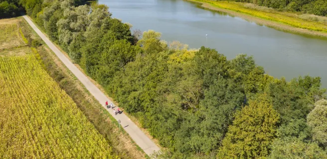
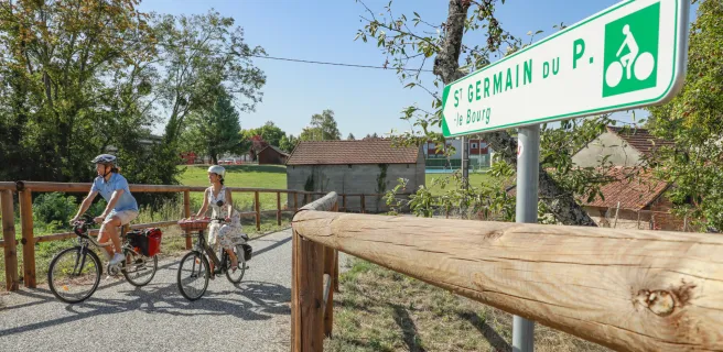
This first stage of the Voie Bressane runs not far from the Saône River, first directing you along an urban greenway much loved by young locals on bikes and push-scooters, up to Ouroux-sur-Saône. Then, a bit after Saint Germain du Plain, where Saint Germain Tower draws your attention, the route leads you gently southeastwards, through woods and hedge-divided fields. A lovely stretch takes you on through the heart of the Bresse Bourguignonne via quiet country roads to just after Montret. Lastly, you join a greenway again, up to Louhans-Châteaurenaud, a town with a medieval heart to explore.
Louhans / Lons-le-Saunier

2 Louhans / Lons-le-Saunier

28 km
1 h 51 min
I begin
The greenway skirts around Louhans Châteaurenard’s centre, but signposting can guide you to its historic heart, with the cobbled Grande Rue, still the main thoroughfare through town, boasting a staggering 157 arcades. Among the town’s medieval riches, don’t miss the 17th-century Hôtel-Dieu (an historic hospital). After enjoying a bumpy tour of the town centre by bike, cycle off in the direction of the Jura Mountains’ foothills. Crossing the motorway, you cross the frontier between the French counties of Saône-et-Loire and Jura. The route leads you gently on to the town of Lons-le-Saunier, bringing you out beside the site where the famed La Vache qui rit (Laughing Cow) cheese is made.
Afficher les étapes