Draguignan / Cannes
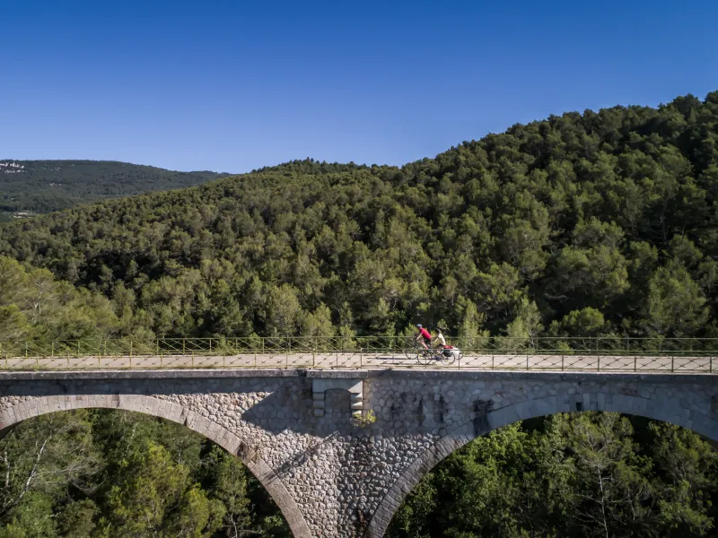

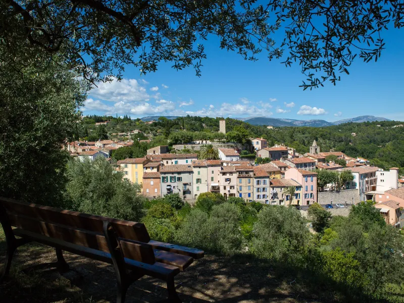
Leaving Draguignan, tackle a series of wooded hills up to St-Martin. After a stretch crossing St-Pons’s vine-filled valley, the Mediterranean Cycle Route route joins the Route des Gorges at the level of Figanières. After the charming village of Callas, a steep ascent to the Boussaque Pass is then counterbalanced by a lovely descent along the D25 road to Bargemon. Next, a former rail line going through wooded slopes acts as your guide, the highlight here Rayol Viaduct, before you reach Fayence, reputed for hang-gliding. Lastly, the route follows small county roads around Grasse, known for its fields of flowers, used to make world-famous perfumes, before leading you down to the Med and Cannes.
Gradients and elevation
Road types
Surface
The route
At time of writing, the route is not signposted until you reach Pégomas. It includes some tough ascents, for example leaving Draguignan, with the stretch via the Chemin des Vieux Chênes having a 20% slope.
Between Callas and Bargemon, you join the Var cycling circuit, the Route des Gorges.
Take care from Fayence on, as the route leads you along the D19 road, which is narrow and busy with traffic.
Take care: the D562 and D2562 roads to Grasse are both steep and used by a lot of traffic.
You leave Grasse via the shared hiking track of the GR51, with some stretches along DFCI (Défense de la Forêt Contre les Incendies) tracks. These stretches are really for seasoned cyclists and more easily tackled with a mountain bike.
There is no signposting for the Méditerranée à Vélo along this stage, except between Pégomas and Cannes.
Link
Towards Grasse: to reach Grasse, you need to go along a stretch of the D2562 road, which is very busy as well as steep, before skirting round via Le Tignet. Follow the signposts for the cycle route towards Peymeinade/Grasse. Take care crossing the D2562 road arriving at the Avenue des Baumettes. Then ascend gradually to Grasse, first sharing the GR hiking path, then a portion of former railway line, with magnificent views onto the Siagne Canal.
PRACTICAL INFORMATION
Tourist Offices
Office de tourisme intercommunal de Dracénie
33 (0)4 98 10 51 05
Bureau d’information touristiquede Bargemon
33 (0)4 94 47 81 73
Office de tourisme du Pays de Fayence
33 (0)4 94 76 20 08
Office de tourisme du Pays de Grasse
33 (0)4 93 36 66 66
Office de tourisme de Cannes
33 (0)4 92 99 84 22
SNCF train stations
Arcs-sur-Argens / Draguignan station
Grasse station
Mouans-Sartoux station
Mandelieu La Napoule station
Ranguin – Cannes station
La Frayère – Cannes La Bocca station
Le Bosquet – Cannes La Bocca station
Cannes La Bocca station
Cannes station
Consult the timetables