15 stages · 757 km

Gradients and elevation

Ascents: 23816m
Descents: 24188m
Lowest point: 2m
Highest point: 2764m

Road types

748km (99%) By road
9km (1%) Cycle path

Surface

100km (200%) Smooth

15 stages used

Thonon-les-Bains / Morzine-Avoriaz

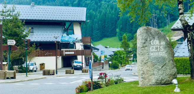
1 Thonon-les-Bains / Morzine-Avoriaz

50 km
3 h 49 min
I cycle a lot
This is the first or last stage on the Route des Grandes Alpes®, depending on the direction in which you tackle the route, leaves from or ends at Thonon-les-Bains, a resort on the south bank of Lake Geneva, one of Europe’s largest natural lakes, with its French Riviera feel. Note that Thonon-les-Bains is the starting point of the great alpine itineraries, as well as the second stage of the ViaRhôna cycling route, which links Lake Geneva to the Mediterranean. Our objective being to improve the safety of cyclists and their experience of roaming, we propose here an alternative to the historical and signposted Route des Grandes Alpes®.
Morzine-Avoriaz / Cluses

2 Morzine-Avoriaz / Cluses

48 km
3 h 10 min
I cycle a lot
This second stage of the Route des Grandes Alpes® ends or begins, depending on the direction of your itinerary, a beautiful first part of the route dedicated to the crossing of the north of Haute-Savoie: from the Chablais massif to the Arve valley. This superb postcard, composed of gorges, passes, wooded slopes, mountain pastures and very beautiful villages, will delight all the cyclists. Our objective being to improve the safety of cyclists and their experience of roaming, we propose here an alternative to the historical and signposted Route des Grandes Alpes®.
Cluses / Le Grand-Bornand

3 Cluses / Le Grand-Bornand

30 km
1 h 56 min
I cycle a lot
On the menu on this stage is a climb worthy of a Tour de France… of which there are very many along the Route des Grandes Alpes®! Here, you tackle the Col de la Colombière pass. That’s not all, as the stage offers up several Haute-Savoie surprises: the resort of Le Grand-Bornand; the Chartreuse du Reposoir (an historic religious establishment); the Bargy Range; the Aravis Range; and the villages of Le Reposoir and Romme, perched on their natural balconies. If not in a rush, from Le Grand-Bornand village, ride to the end of the Bouchet Valley for a detour you won’t regret!
Le Grand-Bornand / Beaufort-sur-Doron

4 Le Grand-Bornand / Beaufort-sur-Doron

57 km
3 h 48 min
This Route des Grandes Alpes® stage between Le Grand-Bornand and Beaufort-sur-Doron passes via La Clusaz, Val d’Arly’s four mountain resorts and that of Les Saisies, plus the village of Hauteluce. You cross between the counties of Haute-Savoie and Savoie. Expect breathtaking views of Mont Blanc, typical mountain villages, plus, in summer, Alpine meadows in flower, ingredients for an unforgettable day’s cycling. It’s made all the better for having two passes to conquer: the Col des Aravis, part of the border between Savoie and Haute Savoie, and the Col des Saisies, gateway to the Beaufortain Range. NB: Saint-Jean-de-Sixt, a village equidistant between Le Grand-Bornand and La Clusaz, is the starting point for an alternative section, involving two stages, taking you via Annecy Lake.
Beaufort-sur-Doron / Bourg-Saint-Maurice

7 Beaufort-sur-Doron / Bourg-Saint-Maurice

40 km
2 h 38 min
I cycle a lot
A magnificent Route des Grandes Alpes® stage, taking you between the Beaufortain area and the Tarentaise Valley via breathtaking landscapes. Water accompanies you along the way, while Mont Blanc is never far off. Much closer by, the toothy rocky summit of La Pierre Menta watches over your progress. The route wends its way beside lakes, dams and Alpine meadows and up summits, with the climb to the top of the Cormet de Roselend (1968 m) the highpoint, perched above the lake of the same name. From Bourg-Saint-Maurice, choose either to continue along the classic route in the direction of Val-d’Isère and the Col de l’Iseran pass, or to join the Maurienne Valley along an alternative way via the Col de La Madeleine.
Bourg-Saint-Maurice / Val d'Isère

8 Bourg-Saint-Maurice / Val d'Isère

34 km
2 h 04 min
I cycle a lot
A transitional stage it may be, but what an ending it provides, coming from the north, as, once you’ve ridden past Tignes Lake and its gigantic dam, you arrive at Val-d'Isère, one of the most famous of all ski resorts. In its exceptional setting on the edge of the Vanoise National Park, Val-d’Isère is both one of France’s most prestigious ski resorts and a marvellously polished village. It also serves as a kind of base camp for the highest pass along the Route des Grandes Alpes®, the Col de l’Iseran (2764m). Do consider staying here a few days, alternating between cycling, hiking and just drinking in the local atmosphere.
Val d'Isère / Val-Cenis

11 Val d'Isère / Val-Cenis

48 km
3 h 13 min
I cycle a lot
Head out to conquer one of the giants along the Route des Grandes Alpes®, the Col de l’Iseran pass (2764m)! A summer link between the Savoie region’s two great upper valleys, the Tarentaise and the Maurienne, this is without doubt one of the most beautiful passes in the whole of the Alps, as well as boasting the highest Alpine road pass. Even in summer it may be lined with piles of snow. Certainly you’ll feel high up in the mountains, enjoying breathtaking views! On the Maurienne side, or rather, the Haute Maurienne – Vanoise side, before arriving at Val-Cenis, you cross Bonneval-sur-Arc, a member of the association of Les Plus Beaux Villages de France, its houses topped by stone tiles, and Bessans, a magnificent place for cross-country skiing and biatholons, internationally renowned for these sports.
Val Cenis / Valloire

12 Val Cenis / Valloire

57 km
3 h 49 min
I cycle a lot
Yes, this is a linking stage on the Route des Grandes Alpes®, but not any old linking stage, as here you ride along the edge of the Vanoise National Park, through the heart of the Haute-Maurienne Vanoise area. Leaving Val-Cenis, you begin your descent towards Modane, crossing the pretty villages of Termignon, Sollières-Sardières, Bramans, Avrieux and, if you go a bit away from the route, Aussois. Modane is a town undergoing a major transformation and from which you can cross into Italy via the Fréjus road and rail tunnel. You reach Valloire having scaled the Col du Télégraphe pass, topped by the fort of the same name.
Valloire / Briançon

15 Valloire / Briançon

54 km
3 h 36 min
I cycle a lot
If riding south from Valloire along the Route des Grandes Alpes®, you’ll soon understand why the Maurienne’s largest mountain resort has added the word ‘‘Galibier’’ to its name. In contrast, heading north, you first have to tackle the Col du Lautaret pass (2057m) before the Col du Galibier (2642m), after which you can enjoy a giant glide down (descending 1300m in altitude) to the aptly-named Valloire-Galibier. Whichever way you take on this stage, crossing the frontier between France’s Northern and Southern Alps makes for a memorable occasion, with staggering views over the glaciers of the Écrins Range. Briançon, at the start or end of the stage, has been awarded the status of Ville d’Art et d’Histoire for its rich heritage and forms part of a UNESCO World Heritage Site for its Vauban fortifications.
Briançon / Guillestre

19 Briançon / Guillestre

50 km
3 h 14 min
I cycle a lot
Depending on the direction in which you’re tackling the route, this iconic stage is either the first or the last on the southern half of the Route des Grandes Alpes®. It presents you with two cycling gems. The first is the climb to the Col de l’Izoard (2360m), passing via the Casse Déserte where, in the midst of impressive, arid surrounds, curious rocky spikes rise from the ground. The second is the crossing of the Queyras Natural Regional Park, dotted with beautiful villages, notably Arvieux and Château-Queyras, the latter with its 13th-century fortress. The giant Monte Viso Mountain looks down on it all from the Italian border. The two book ends stops on this stage are also remarkable: Guillestre, a pretty, colourful little town; and Briançon, awarded Ville d'Art & d'Histoire status for its rich heritage and forming part of a UNESCO World Heritage Site for its Vauban fortifications.
Guillestre / Barcelonnette

20 Guillestre / Barcelonnette

50 km
3 h 20 min
I cycle a lot
This Route des Grandes Alpes® stage links the Queyras and Ubaye areas, and the counties of Hautes-Alpes and Alpes de Haute-Provence. In addition, it offers stunning views to the Écrins Range. The highlight, and high point, is the Col de Vars pass (2108m), demanding a 1111m shift in altitude. Pretty villages like Saint-Paul-sur-Ubaye and Jausiers, along with splendid landscapes, are the rewards along this stage. Barcelonnette, a charming little town with a distinctive colonial style recalling its strong connections with Mexico – hence its renowned villas mexicaines – has a unique atmosphere among Alpine stops. If you wish to explore Serre-Ponçon Lake, then take the alternative stage via Embrun to the lakeside.
Barcelonnette / Valberg

22 Barcelonnette / Valberg

76 km
5 h 00 min
I cycle a lot
A lovely 77km-long stage that includes taking on the Col de la Cayolle pass (2326m), one of the wildest along the Route des Grandes Alpes®, on the border between the counties of Alpes-de-Haute-Provence and Alpes Maritimes. If cycling south, there’s also the Col de Valberg pass (1671m) to climb, leading to Valberg itself, set in the Haut-Pays Niçois (part of Nice Métropole’s soaring hinterland), a mountain resort that has kept its village feel and been awarded Flocon Vert status for its commitment to sustainable tourism. The landscapes are vast and unspoilt as you cross a portion of the Mercantour National Park; cyclists may be surprised by their austere openness and be tempted to dismount for a little walk. Going down the Val d’Entraunes following the Var River to Guillaumes is a pure delight.
Valberg / Saint-Martin Vésubie

25 Valberg / Saint-Martin Vésubie

59 km
3 h 47 min
I cycle a lot
A superb stage on the Route des Grandes Alpes®, with grandiose landscapes, views to the Mercantour’s summits, vast red cliffs, villages either nestling down in the valleys or perched on cliffs. Among them, Roubion, a medieval eagle’s eyrie with narrow lanes, is well worth a detour, as is Saint-Martin-Vésubie, a wonderfully colourful village located either at the start or end of this sporty outing, requiring almost 1600m in shift in altitude. There are two passes to conquer: the Col de la Couillole (1678m), between Valberg and the Tinée Valley; and the Col Saint Martin (1503m), which, with the little mountain resort of La Colmiane beside it, links Tinée and Vésubie Valleys.
Saint-Martin Vésubie / Sospel

26 Saint-Martin Vésubie / Sospel

51 km
3 h 26 min
I cycle a lot
This Route des Grandes Alpes® stage covering the Vésubie Valley and Haut-Pays Niçois takes you over the Col de Turini pass (1607 m), made famous by the Monte Carlo Car Rally. Also on the menu are: the magnificently colourful village of Saint-Martin-Vésubie; La Bollène Vésubie, a beautifully rounded hilltop village; grandiose landscapes combining gorges and perched promontories; and the small town of Sospel, with its picturesque squares and lanes… not forgetting Roquebillière, the Côte d’Azur’s thermal spa resort, protected from summer heatwaves thanks to its location, at 600m above sea level.
Sospel / Nice

27 Sospel / Nice

52 km
3 h 01 min
I cycle a lot
Now here’s an unforgettable day’s cycling! Coming from the north, with your legs feeling the effects of tackling the Route des Grandes Alpes® (in part or in its entirety), the sight of the Mediterranean, signalling the end of your cycling adventure, can bring out powerful emotions! In contrast, heading north from Nice’s sumptuous Promenade des Anglais, you may feel giddy at the thought of all the cycling adventures to come. On the menu along this maritime stage are two significant rises, taking you to the Col d’Èze (507m) and the Col de Castillon (703m), as well as the resort of Menton and stunning views down on Monaco.
Afficher les étapes