6 stages · 257 km

Gradients and elevation

Ascents: 4993m
Descents: 5013m
Lowest point: 293m
Highest point: 1212m

Road types

231km (90%) By road
26km (16%) Unknown
26km (16%) Provisional itinerary

Surface

50km (200%) Smooth

6 stages used

Grasse / Saint-Vallier-de-Thiey

1 Grasse / Saint-Vallier-de-Thiey

25 km
1 h 40 min
I cycle a lot
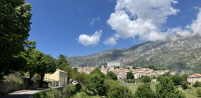
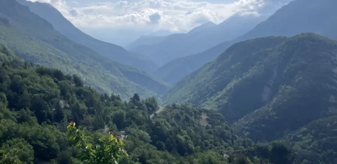
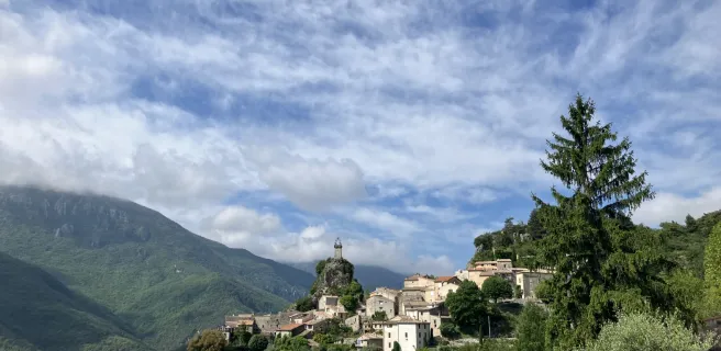
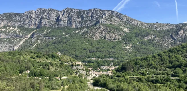
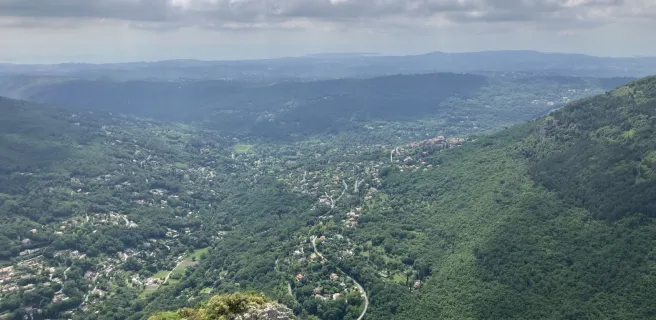
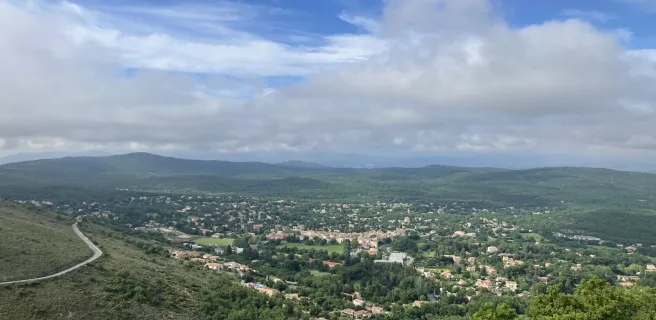
After visiting the world capital of perfume-making, time to cycle off towards St Cézaire sur Siagne, on one of the region’s panoramic roads known as the balcons d’azur (the name for the trails in the unspoilt hills behind the French Riviera). Looking sidewards, marvel at the breathtaking views down on the Mediterranean and on the inland St-Cassien Lake, as well as enjoying the green mountains of the arrière pays grassois, the rugged terrain inland from Grasse. Perched villages and head-spinning viewing points are dotted along this first stage leading to St Vallier de Thiey. Before that, leaving St Cézaire sur Siagne, in the far distance, you may make out the Thiey and Audibergue Mountains, but focus first on the hairpin bends leading up to the Col de la Lèque, a pass that you need to cross to win your spurs as a cyclist off to conquer the Grand Tour des Préalpes d’Azur.
Saint-Vallier-de-Thiey / Thorenc

2 Saint-Vallier-de-Thiey / Thorenc

42 km
2 h 46 min
I cycle a lot
Steering cyclists further away from the bustle of the French Riviera, this stage of the Grand Tour des Préalpes d’Azur starting from St Vallier de Thiey leads riders up to the Col du Ferrier, a pass set between Thiey Mountain and the surprising Caussols Plateau. You enter the luminous, peaceful landscapes of the Parc Naturel Régional des Préalpes d’Azur, riding along the D5 road to the Col de la Sine. Next, head east for the Gorges du Loup, the way following the rushing river before you climb to Gréolières. From Gréolières, the cycle route continues to encourage you to climb to the mountain ski resort of Gréolières-les-Neiges. Flanked by the Cheiron and Bleine Mountains to the north and the Calern Plateau and Audibergue Mountains to the south, savour the grandiose setting of the Plan du Peyron up to Thorenc.
Thorenc / Aiglun

3 Thorenc / Aiglun

50 km
3 h 19 min
I cycle a lot
You continue riding onwards at an average altitude of approximately 1,100 m as you leave the Plan du Peyron and Lane Valley to head further into France’s pre-alpine ranges via the Artuby Valley. On this stage, the Grand Tour des Préalpes d’Azur briefly takes you into the French county, or département, of Alpes de Haute-Provence. After the village of La Foux, as ever on a road shared with motorized traffic, you ride through scenic Alpine landscapes to reach the outskirts of St Auban and the confluence of the Estéron and Faye Rivers. Next, you cycle along the picturesque little Faye Valley before joining the Les Sausses road to continue through the very narrow, steep Gironde Valley. After the exceptionally spectacular Pont de la Clue, a bridge over the Estéron, climb to the perched village of Aiglun.
Aiglun / Gilette

4 Aiglun / Gilette

49 km
3 h 17 min
I cycle a lot
Leave Aiglun, overseen by the Mont St Martin, its summit at 1,258 m, following the spectacular D10 road, cut out of the rock, looking down on the turquoise-blue waters of the Estéron River. After exploring the medieval village of Sigale and passing the Clue du Riolan, the Grand Tour des Préalpes d’Azur makes you climb to Saint-Antonin and Ascros, splendid views opening up of the ski resort of Valberg. Then the cycle route transforms into something of a great long tobogganing trail as you race down the mountainside, Mont Vial towering above, to Gilette and the Var Valley. On the way down, you can explore Provençal villages perched on rocky outcrops and full of sun-drenched colour.
Gilette / Bouyon

5 Gilette / Bouyon

41 km
2 h 43 min
I cycle a lot
This stage of the Grand Tour des Préalpes d’Azur provides a feast of colours, from the deep greens of the woods, down to the deep blues of the Estéron River and up to the azure skies. Along the river’s north bank, as you cycle along, the crystalline waters allow you to appreciate the gently sloping river and hence the natural pools that have formed here, to the delight of bathers. This picturesque scenery lasts up until the Knights Hospitaller-connected villages of Roquestéron and Roque-en-Provence. Then, following the south bank, on the climb to Bouyon, at each turn, the palette of colours changes, with a mix of pines and deep blue skies, the whole creating a vibrant yet peaceful scene, accompanied by the pleasing babble of the water.
Bouyon / Grasse

6 Bouyon / Grasse

50 km
3 h 20 min
I cycle a lot
This final stage of the Grand Tour des Préalpes d’Azur takes cyclists away from the Estéron Valley, back to the Loup River, along its southern stretch. Leaving the picturesque village of Bouyon behind you, follow the Gorges du Bouyon, then there’s a short climb to Coursegoules. Enjoy a long descent, not just for the elating ride, but also to admire the villages of Gourdon, Cipières and Gréolières, standing out against the surrounding mountains. Follow the Gorges du Loup before climbing to Gourdon to savour a final 360° view over the Préalpes d’Azur. Lastly, you’ll feel almost as though you’re diving like a peregrine falcon on the descent towards Grasse. It makes an exhilarating end to this uplifting cycling adventure around the high limestone plateaux of the Provençal Alps.
Afficher les étapes