3 stages · 120 km

Gradients and elevation

Ascents: 558m
Descents: 544m
Lowest point: 0m
Highest point: 111m

Road types

39km (32%) By road
82km (68%) Cycle path
26km (21%) Provisional itinerary

Surface

86km (200%) Smooth

3 stages used

Sanary-sur-Mer / Hyères

1 Sanary-sur-Mer / Hyères

43 km
2 h 51 min
I begin
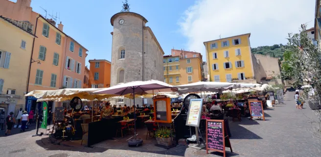
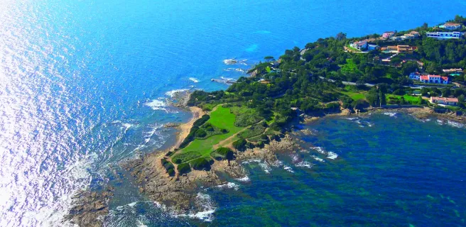
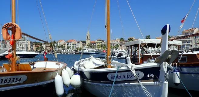
This first, western stage along the Parcours Cyclable du Littoral Varois (often abbreviated to the PCL) begins at the picture-postcard port of Sanary-sur-Mer. Feel the joys of cycling in the South of France, with cooling dips in the sea possible. To take in the entire view across the Bay, or Rade, of Toulon, you need to tackle the slope up to the level of the military fort of Six-Fours, known as the eyes and ears of the Mediterranean! After Toulon, this stage provides plenty of discoveries, the cycle route following the well-shaded trail of the former railway line linking Toulon to St Raphaël, with few slopes to tackle. The Route du Sel (or Salt Route), closed to car traffic in winter, proves a delight for cyclists wishing to explore the Presqu’île de Giens, a splendid peninsula. If tempted by the islands just offshore, ferries provide links to the Îles de Porquerolles so close by!
Hyères / Grimaud

2 Hyères / Grimaud

51 km
3 h 22 min
I cycle often
The Parcours Cyclable du Littoral continues alongside Hyères Bay, taking you around the salt marshes before leading you northeastwards towards the Massif des Maures hill range. All along this stage, you’ll greatly appreciate the shade and scent provided by the pines. After La Londe les Maures, you gradually descend along an intoxicating stretch to the resort of Le Lavandou, where you join the former railway track built to serve Toulon-St Raphaël. The cycle route, perched on something of a balcony between the sea, the D559 road, and the hills above, wends its way through rocky terrain, offering majestic views of the Mediterranean and its creeks. After Cavalaire-sur-Mer, a gentle climb to La Croix-Valmer leads you through pine woods to the top of the Massif des Maures range before you descend to Port-Grimaud, a town built on water.
Grimaud / Fréjus

3 Grimaud / Fréjus

28 km
1 h 50 min
I cycle often
Having gone on foot to explore Port-Grimaud, a town built on water, the Parcours Cyclable du Littoral Varois continues by leading you around the Bay, or Golfe, of St-Tropez. In hot weather, it’s so refreshing taking a dip in the Mediterranean. Arriving at the resort of Ste Maxime, at the level of the Plage de la Croisette (a beach here), the coastal cycle route comes to a temporary halt. You’re led northwestwards along the Préconil River, then eastwards, along a path looking down on the coast. Riders rejoin a former railway track, a balcony of a way, to ride boldly along the Train des Pignes former rail track, the path set between the foothills of the Massif des Maures and the coast road, with panoramic views over the Mediterranean. You arrive at the resort of Fréjus via the Argens Estuary.
Afficher les étapes