15 stages · 357 km

Gradients and elevation

Ascents: 1396m
Descents: 1416m
Lowest point: 0m
Highest point: 306m

Road types

128km (36%) By road
16km (17%) Provisional itinerary
255km (71%) Cycle path

Surface

315km (88%) Smooth
17km (6%) Unknown
25km (11%) Unpaved
26km (7%) Rough

15 stages used

Saint-Malo / Cancale

14 Saint-Malo / Cancale

18 km
1 h 14 min
I cycle a lot
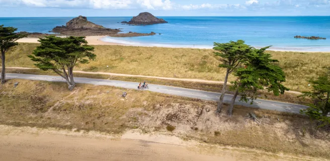
Leaving the corsair city of St-Malo, the Vélomaritime leads you towards a port renowned for producing high-quality oysters, Cancale. Beyond St-Malo's great beach, seek out the carved rocks of Rothéneuf, the startling sculptures here executed by an abbot turned hermit. Midway along the stage, explore the peaceful village of Saint-Coulomb and La Ville Bague, a malouinière, or typical Ancien Régime manor built for a wealthy St-Malo merchant. Your reward at the end of the day's cycling is a tasting of oysters in the very pretty port of Cancale.
Cancale / Le Vivier-sur-Mer

15 Cancale / Le Vivier-sur-Mer

21 km
1 h 21 min
I cycle often
Welcome to a culinary stage to savour! Between Cancale and Le Vivier-sur-Mer, you ride past one of the Bay of the Mont Saint-Michel's major areas for mussel cultivation, reputed for its high-quality moules de bouchot (grown on posts and granted AOP status).
Le Vivier-sur-Mer / Mont-Saint-Michel

16 Le Vivier-sur-Mer / Mont-Saint-Michel

29 km
1 h 54 min
I begin
There it is, in front of you, drawing closer with each turn of the pedals – the magical Mont Saint-Michel! Heading for Normandy's medieval marvel by bike is surely the best way to approach the great abbey-topped island rising so startlingly out of the sea. A feast for the eyes, this stage also allows you to take in the charming bay-side village of Cherrueix with its windmills, St Anne's Chapel, the local marshes and polders, and the Couesnon River.
Mont-Saint-Michel / Ducey-Les Chéris

17 Mont-Saint-Michel / Ducey-Les Chéris

23 km
2 h 03 min
I begin
The Vélomaritime route leaves Normandy's Marvel behind, taking you via minor roads across salt-meadows. Make the most of the last glimpses you're afforded across to the Mont Saint-Michel set in its great bay before reaching the Sélune Estuary, your gateway to the traditional bocage normand landscapes, consisting of hedge-divided fields. A lovely greenway leads you gently to the centre of the well-flowered village of Ducey.
Ducey-Les Chéris / Saint-Hilaire-du-Harcouët

18 Ducey-Les Chéris / Saint-Hilaire-du-Harcouët

19 km
1 h 15 min
I begin
This Vélomaritime stage shares the way with the Véloscénie cycle route, taking you along a former railway track converted into a greenway, leading to St-Hilaire du Harcouët. Founded and fortified by a comrade-in-arms to William the Conqueror, this fortress town strategically placed between the Cotentin Peninsula, Brittany and French Maine (now in the Pays de la Loire Region) offers a variety of activities in summer based around the Plans d'eau du Prieuré, a series of lakes.
Saint-Hilaire-du-Harcouët / Mortain-Bocage

19 Saint-Hilaire-du-Harcouët / Mortain-Bocage

11 km
43 min
I begin
Leading you along slopes, this Vélomaritime stage guides you gently towards Mortain, at the green heart of Normandy's extensive area of typical hedge-divided fields, known as the bocage, and located where our route meets the Véloscénie cycle route. The greenway on this stage takes you close to the enchanting Cance waterfall. Do go and see it in its wild, steep setting, clearly showing how this part of Normandy is part of the wider Armorican granite peninsula.
Mortain-Bocage / Vire Normandie

20 Mortain-Bocage / Vire Normandie

43 km
2 h 50 min
I begin
The sound of the largest waterfalls in northwest France still ringing in your ears, continue riding along a greenway through the hedge-divided fields of the Normandy bocage. Here, green dominates the scene and the typical Normandy countryside imparts a feeling of well-being. Once past Sourdeval, the Vélomaritime route leads on to Vire, a town rebuilt after the 1944 Allied bombings. The place has preserved its lively traditional market and is reputed for its culinary and craft heritage.
Vire Normandie / Pont-Farcy

21 Vire Normandie / Pont-Farcy

36 km
2 h 10 min
I cycle often
The Vire Valley acts as the thread along this Vélomaritime stage. After a stretch of greenway, you ride along minor roads through Normandy hedge-row-divided fields and valleys. With its ups and downs, this stage provides splendid views over the Vire's meanders and leads to La Ferrière-Harang, followed by the peaceful village of Pont-Farcy, nestled in a green corner beside the river. Highlight of the day is perhaps cycling under the grand Souleuvre Viaduct.
Pont-Farcy / Saint-Lô

22 Pont-Farcy / Saint-Lô

32 km
2 h 06 min
I begin
5 / 5
Your cycling trip continues gently along the picture-postcard Vire towpath, with peaceful meadows where sheep and horses graze, wild hedges full of flowers in season, and enchanting villages, including lively little Tessy-sur-Vire. Along the way, don't miss the detour to Les Roches de Ham, providing spectacular views over the Vire Valley and the Pays Saint-Lois area. The Vire's waters long attracted numerous craftspeople, including weavers, tanners and washerwomen, while many barges, houseboats and gabarres, traditional boats, are still to be seen along this picturesque valley.
Saint-Lô / Saint-Jean-de-Daye

23 Saint-Lô / Saint-Jean-de-Daye

23 km
1 h 30 min
I begin
The dynamic town of Saint-Lô, despite being heavily bombed in 1944 as World War II was reaching a climax in France, has preserved an exceptional heritage, notably the national stud farm, the Haras National, which you can visit, and the town's medieval ramparts. The Vélomaritime cycle route then continues beside the Vire Canal, meandering along up to St-Jean-de-Daye, through picture-postcard countryside.
Saint-Jean-de-Daye / Carentan-les-Marais

24 Saint-Jean-de-Daye / Carentan-les-Marais

19 km
1 h 16 min
I begin
You leave behind the typical Normandy hedge-divided fields to enter wetlands boasting an impressive network of channels and canals. The Vélomaritime here also leads you into the heart of one of France's main horse-breeding areas. Keep your eyes peeled for signs indicating the way to local racecourses. Reaching Carentan, nestled in the Baie des Veys, its yachting harbour immediately takes you back to a coastal atmosphere on your cycling adventure.
Carentan-les-Marais / La Haye

25 Carentan-les-Marais / La Haye

22 km
1 h 27 min
I begin
You ride through the heart of the Parc Naturel Régional des Marais du Cotentin et du Bessin via a lovely greenway. Keep binoculars to hand, as the wetlands here are home to an exceptional variety of species of birds. During migration seasons, the spectacle of vast colonies of birds filling the skies is quite magical. Also make the most of the magnificent sunrises and sunsets over the marshes! You end the stage at La Haye-du-Puits, which, although it suffered major destruction during World War II, was lovingly restored and is now a lively, attractive village.
La Haye / Saint-Sauveur-le-Vicomte

26 La Haye / Saint-Sauveur-le-Vicomte

14 km
1 h 01 min
I begin
The Vélomaritime route leaves La Haye-du-Puits and its 11th-century keep, still defying time. This stage offers easy cycling along a green ribbon lined by trees, affording you lovely glimpses of the little valleys to the sides. Saint-Sauveur-le-Vicomte and its medieval château, which was besieged twice in the Hundred Years War, welcome you at the end of this stage.
Saint-Sauveur-le-Vicomte / Bricquebec-en-Cotentin

27 Saint-Sauveur-le-Vicomte / Bricquebec-en-Cotentin

14 km
54 min
I begin
Going from Saint-Sauveur-le-Vicomte to Bricquebec and from one medieval château to another, you cycle peacefully along a safe, peaceful greenway, roughly at the pace of the former little train that used to run along the track here! You're crossing through a Pays d’Art et d’Histoire, Le Clos du Cotentin, a rich cultural area on the edge of the wetlands of the Marais du Cotentin and of the most important state forest in the county of Manche.
Bricquebec-en-Cotentin / Cherbourg-en-Cotentin

28 Bricquebec-en-Cotentin / Cherbourg-en-Cotentin

35 km
2 h 00 min
I begin
Leaving behind Bricquebec, you pedal along peaceful roads lined with farms and villages. You'll note the talus, high banks dividing up the meadows, fields and orchards, creating a typical Normandy landscape. Brix is your last stop before Cherbourg, with its ferry services to England and Ireland. At Cherbourg's port, a cycle path runs alongside one of the longest harbour walls in the world, dating as far back as 1783.
Afficher les étapes