All types of routes

Grande Traversée du Jura by mountain bike

Official mountain bike route
L. CHEVIET
Sommet du Mont d'Or
Belvédère de Fougères sur la GTJ à VTT
L. CHEVIET
Descente sur La Cernée
L. CHEVIET
Panorama vers La Cernée
Le long du Doubs
L. CHEVIET
Bellefontaine sur la GTJ à VTT
GTJ à VTT à Mouthe
Le plateau de Retord à VTT
Ascension du Grand Colombier à VTT
Belvedère du Fenestré
One way
Mountain bike
425 km
1 week or more
I cycle a lot
Mandeure
Culoz
Mountains

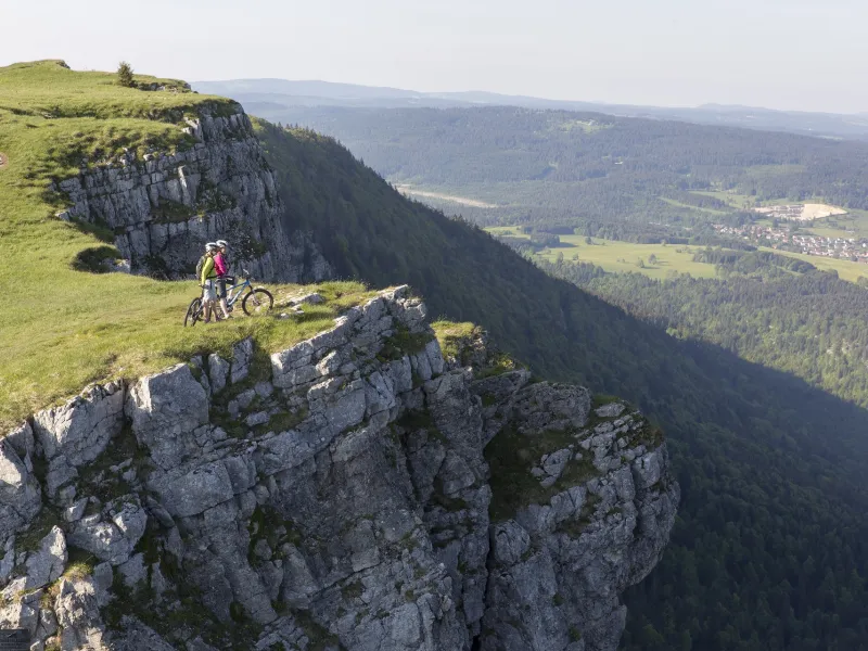
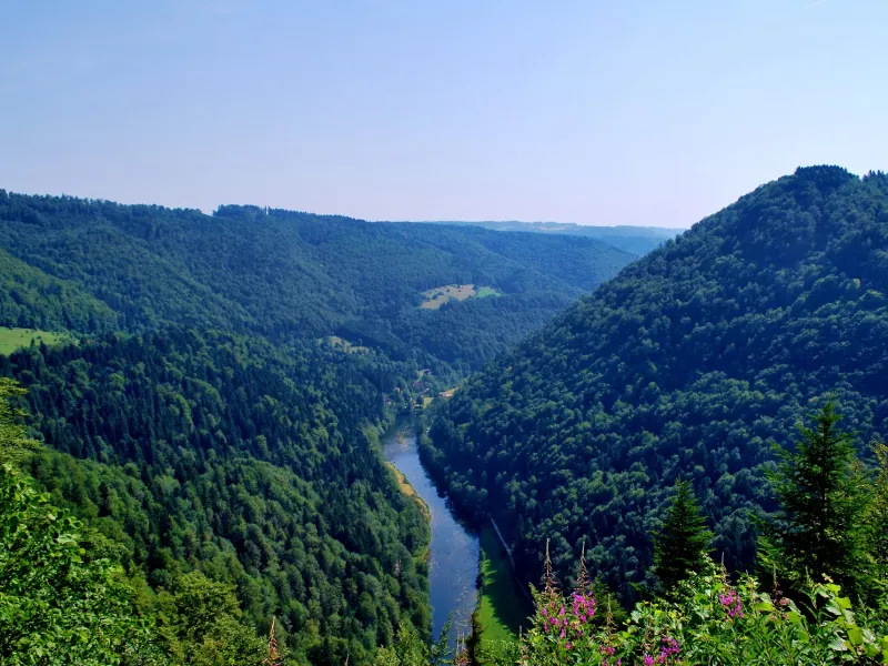
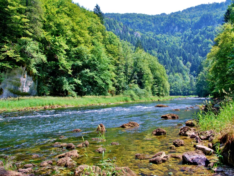
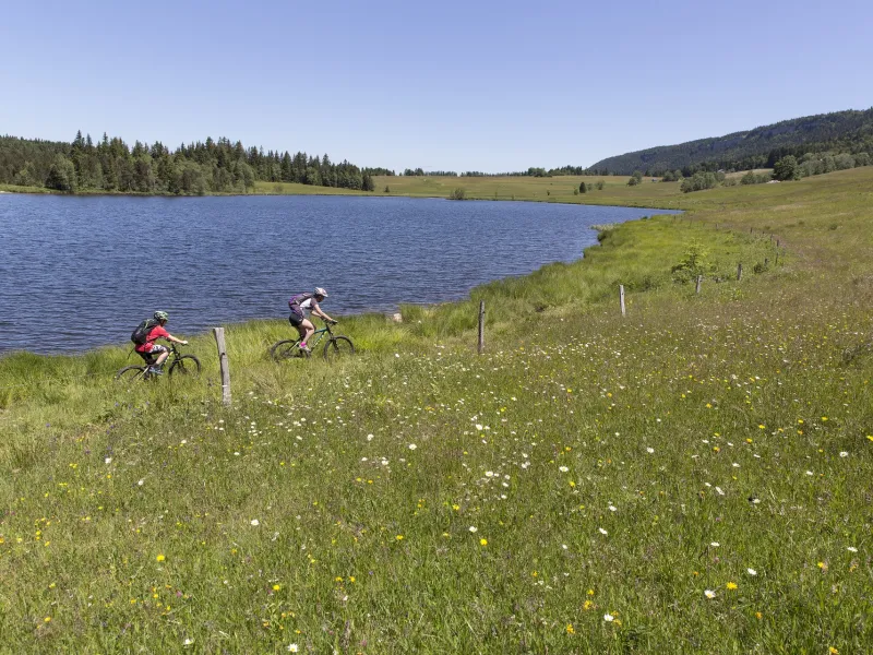
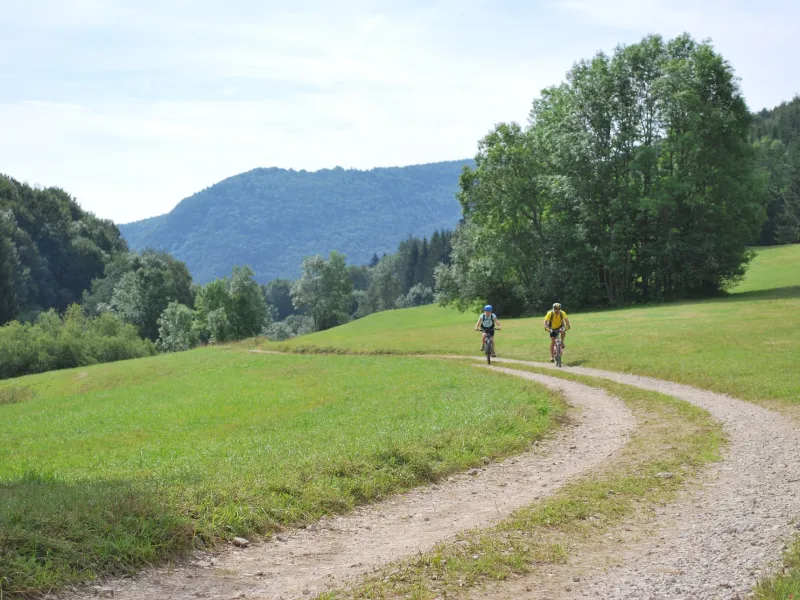
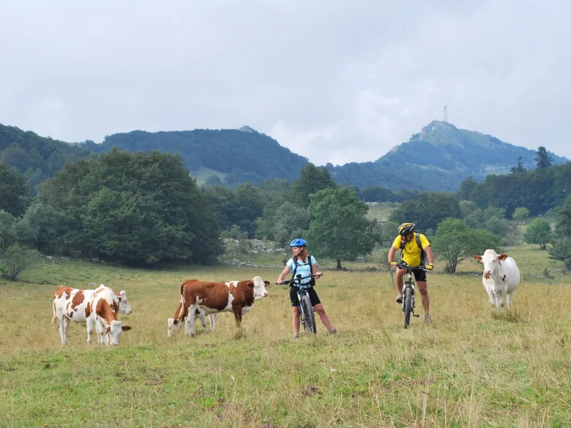
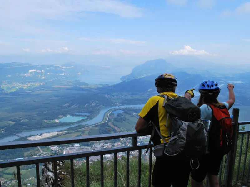
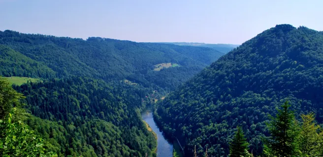
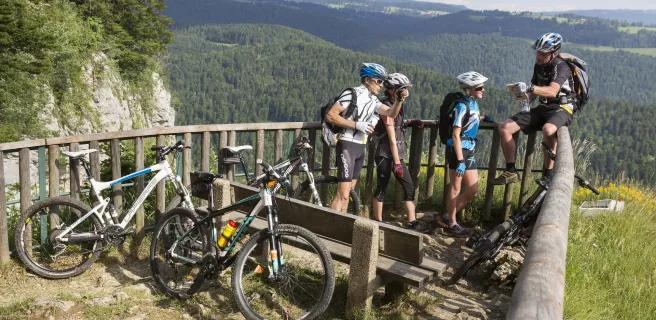
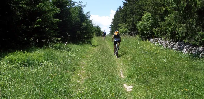
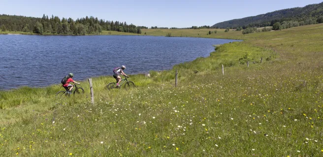
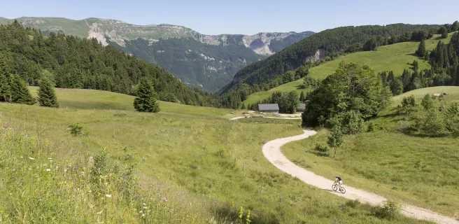
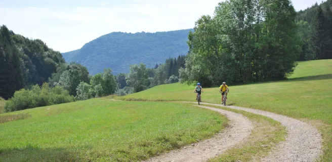
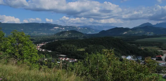
Race off along exciting mountain bike paths through the Jura Mountains to conquer their summits and take in their varied landscapes and splendid views. The GTJ starts from the town of Mandeure, north of the Jura Range, in the French county of Doubs. It wends its way south to Culoz in the county of Ain. Along the first stages, you remain close to the River Doubs, its blue gorges contrasting with green meadows and forests. You then arrive at the Parc Naturel Régional du Haut-Jura, the terrain increasingly mountainous. Passing by deep limestone combes and through vast open expanses, you end up at the foot of the Grand Colombier Mountain, finishing point for this wild "Grande Traversée" by MTB.

Signposting and layout of the GTJ by mountain bike

The Grande Traversée du Jura mountain biking route (or GTJ VTT in French) is signposted in both directions. The colour of the signs for the GTJ differs from that for other Grandes Traversées by MTB (in red) because the former were put in place at an earlier date than the latter.

At some of the main crossroads along the way, you’ll spot signposts. On these, the GTJ route indicators have been placed on the relevant directional arrows.

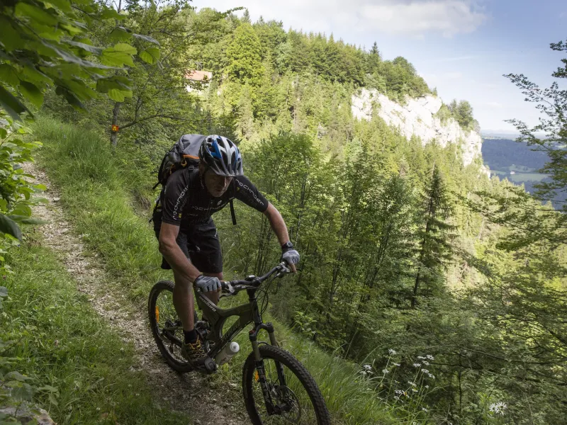
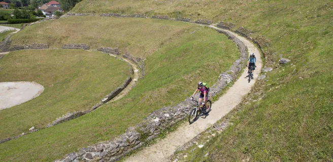
Certain portions of the route are fairly technically challenging, so somewhat easier, or ‘light’, alternatives are suggested in the accompanying Carto Guide.

Which bike to choose?

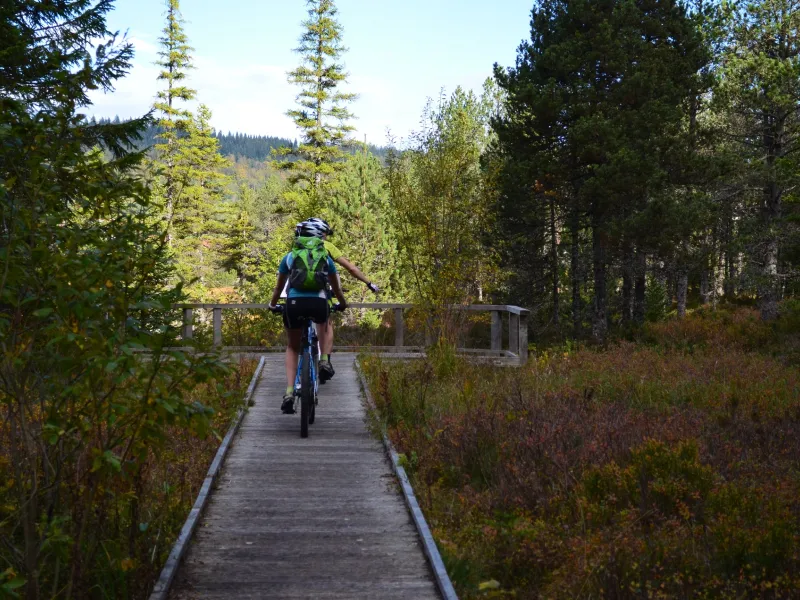
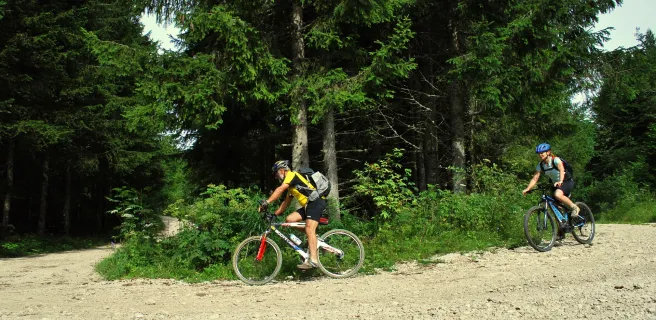
A mountain bike is the most suitable choice for this route. Really experienced cyclists could tackle it on a gravel bike. You can avoid the most challenging sections by opting for the easier, ‘light’ alternatives described in the relevant Carto Guide.

An electric mountain bike is another option to consider, with several charging points you can use inside some of the tourist offices along the route.

Best months to go

Between April and October. In June and July, you can enjoy the sight of fields of narcissi in flower.

Gradients and elevation

Ascents: 7889m
Descents: 7986m
Lowest point: 233m
Highest point: 1350m

Trains et transport sur Grande Traversée du Jura by mountain bike

  • Montbéliard: the station closest to the starting point at Mandeure. From here, you can cycle along the GTJ à Vélo way to get to the starting point.
    On TER regional train line: Lyon - Montbéliard - Belfort
  • Culoz: TER station for the southern point of the cycle route
    On TER regional train line Lyon - Culoz - Genève

Consult possibilities for taking your bike on trains around France

"Accueil Vélo" accommodation on Grande Traversée du Jura by mountain bike

39 Accueil Vélo accommodations await you on Grande Traversée du Jura by mountain bike!

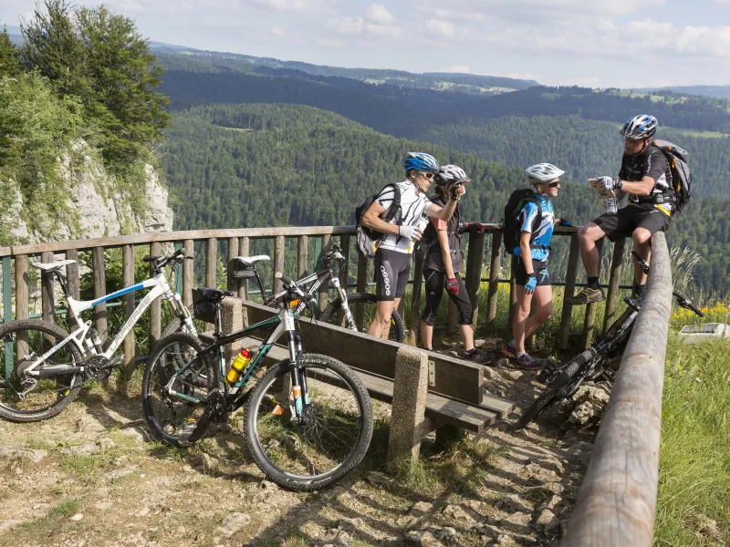
The 12 stages of Grande Traversée du Jura by mountain bike

Mandeure / Saint-Hyppolite

1 Mandeure / Saint-Hyppolite

32 km
2 h 09 min
I cycle a lot
Start your adventure along the Grande Traversée du Jura by mountain bike at Mandeure, a town south of larger Montbeliard that boasts the ruins of a Gallo-Roman theatre. On this first stage, follow the Doubs River to the historic fortified small town of Saint-Hippolyte, nestled at the confluence of Doubs and Dessoubre. The reward for the physical and technical challenges on this first stage is beautiful landscapes, best appreciated from the viewing points (belvédères)
Saint-Hyppolite / Goumois

2 Saint-Hyppolite / Goumois

29 km
1 h 56 min
I cycle a lot
Leaving Saint-Hippolyte, this GTJ by MTB stage starts with a long climb, following a former Roman road up to the Plateau de Maîche, with lovely views over the Doubs Valley. Then the route plunges you back down to the river gorges and a spot beloved of anglers. Give your legs a rest on the riverbank, admiring the fly-fishermen’s skills, ‘tickling’ the trout and rainbow trout teeming in the waters.
Goumois / Fournet-Blancheroche

3 Goumois / Fournet-Blancheroche

19 km
1 h 16 min
I cycle a lot
At Goumois, crossing the river, you enter Swiss territory. For a few kilometres, the GTJ by MTB stays in Switzerland, taking you through the wild Gorges du Doubs. This stage is magical but challenging. The names of certain spots speak volumes; at the Echelles de la Mort (‘the Ladders of Death’), get off your bike to experience the thrill of smugglers who used to climb the cliffs here to secretly carry goods across the border. Before reaching Fournet-Blanche-Roche, take on an extra few hundred meters to appreciate the extraordinary views over the Doubs Valley from the Belvédère de la Cendrée.
Fournet-Blancheroche / La Perdrix

4 Fournet-Blancheroche / La Perdrix

52 km
3 h 26 min
I cycle a lot
The GTJ by MTB ("GTJ VTT") has taken you up to the Plateau de Maîche, with verdant pastures where Montbéliarde cows graze, their milk producing Comté cheese. The way now takes you along ledges perched above the Doubs Gorges, providing several viewing points over the Saut du Doubs waterfall and its pools. Entering the Pays de la Saucisse (Sausage Country – the nickname from the little sausage-producing town of Morteau), admire the magnificent Franche-Comté farms with their distinct hearths (tuyés), sometimes with renowned local smoked meats drying outside: Morteau sausage, dried ham and rustic bacon – specialities to try on a picnic or at a meal.
La Perdrix / Metabief

5 La Perdrix / Metabief

41 km
2 h 44 min
I cycle a lot
Soon, the GTJ VTT mountain biking route leads you to the town of Pontarlier, an entry point to the Parc Naturel Régional du Haut-Jura. Then a technically-challenging path heads up to the Château de Joux, looking proudly imposing on its rocky outcrop dominating a deep narrow valley, or cluse. The track wends its way through shady, majestic spruce and fir making up the Jura forests around here, as far as the resort of Métabief.
Metabief / Chapelle-Des-Bois

6 Metabief / Chapelle-Des-Bois

40 km
2 h 41 min
I cycle a lot
Métabief was made for mountain biking. It was one of the first ski resorts to open its ski slopes to mountain bikes in summer and provides the perfect opportunity to try out downhill mountain biking. At all events, whether by bike or by chair lift, make sure to get to the summit of the Mont d’Or, at 1,463m the roof of the county of Doubs, with breathtaking views across to neighbouring Switzerland and down to the Alps. After that, glide over to Mouthe and visit the source of the Doubs River, which has served as your companion since Mandeure. You’ll encounter a ski jump, recalling that you’re in a part of France specializing in Nordic ski activities.
Chapelle-Des-Bois / Lajoux

7 Chapelle-Des-Bois / Lajoux

42 km
2 h 49 min
I cycle a lot
Chapelle des Bois, with its cliff, lake and peat bog, has something of a Scandinavian feel to it. Following forest tracks, you cross the high-altitude woods of Le Risoux and Le Massacre either side of the ski resort of Les Rousses, where protected species such as capercaillie and lynx are king. Unspoilt, authentic nature has been preserved here. The GTJ by MTB ("GTJ VTT") enters the territory of the Haut-Jura, the landscapes changing, becoming more mountainous.
Lajoux / Giron

8 Lajoux / Giron

37 km
2 h 26 min
I cycle a lot
Approaching the village of Lajoux, the crests of the Haut-Jura appear, along with an extremely beautiful view of the Col de la Faucille pass. In the village, the Maison du Parc will help you understand the terrain you’ve covered so far on your GTJ by MTB ("GTJ VTT") adventure. Crossing the Hautes Combes is a delight, given both the gentle route and the beauty of the natural setting, the easy paths leading you between combes and light woods. All along, the Jura’s summits to the east guard the way, while the Chalam Crest provides a magnificent view onto the geology of the Cirque de Chezery from the so-called Lion frontier stone. You enter the Auvergne-Rhône-Alpes Region and the county of Ain via a lovely descent.
Giron / Les-Plans-D'hotonnes

9 Giron / Les-Plans-D'hotonnes

47 km
3 h 06 min
I cycle a lot
The GTJ mountain biking route ("GTJ VTT") cycle route now leaves the Haut-Jura area as you enter the county of Ain and the very beautiful Retord Plateau. As you descend into the valley that cuts the mountains here in two, consider the staggering natural forces that shaped these landscapes. Around the Plateau de Retord, gentle, tranquil nature is your sole companion. If you are lucky enough to cross the plateau in June or July, you can enjoy the spectacle of the narcissi meadows in flower, their scent filling the air. Around here, these flowers are picked to extract their essence, which goes into perfumes made by famous names.
Les-Plans-D'hotonnes / La-Praille

10 Les-Plans-D'hotonnes / La-Praille

29 km
1 h 55 min
I cycle a lot
You reach the heart of the Haut-Bugey here. In this remote area, the population drain has been halted by concerted efforts to keep community support and traditional life in these mountains thriving. The locals are proud of the way they’ve maintained their traditions in producing Comté cheese. The Grande Traversée du Jura cycle route here leads you through pastureland and forests via small paths and forest tracks. You finish this stage at one of the last high points on your adventure.
La-Praille / Culoz

11 La-Praille / Culoz

32 km
2 h 08 min
I cycle a lot
Make the most of this penultimate stage of the Grande Traversée du Jura by MTB to admire certain distinctive features that can help sum up your adventure. Follow the track to the Observatoire de la Lèbe, wayside panels giving details on the night skies and planets. In the exceptionally beautiful Gorges de Thurignin, admire one last time the distinctive geology that has marked your way along the "GTJ VTT". The little town of Culoz marks the end of the route. At the foot of the mighty Grand Colombier Mountain, it sits beside the Rhône, the natural frontier here with the once-separate state of Savoy.
Les-Plans-D'hotonnes / Culoz

12 Les-Plans-D'hotonnes / Culoz

32 km
2 h 09 min
I cycle a lot
This final stage of the Grande Traversée du Jura mountain biking route ("GTJ VTT") requires good physical fitness. The reward for the effort is well worth it, given the places you pass.
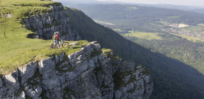
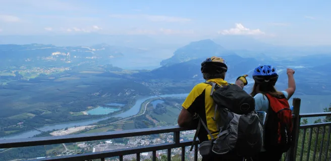
After the vestiges of Arvières Charterhouse, a peaceful place for reflection, head up to the magnificent, magical summit of Le Grand Colombier. Frequently tackled by record-beating cyclists, the 360° views from the top are worth savouring. Then speed down some 1,000m along the route shared with the Grande Randonnée hiking trail, racing through box wood. Or choose the option by road to descend more prudently, enjoying a wry smile as you note the gradients stated on the kilometre markers for cyclists climbing the mountain this way!
Details