In France, cycle routes are signposted and have specific signs.
Cycling facilities are often recognizable by a cyclist's logo on a sign or by a marking on the ground. They can take several forms: lanes dedicated to cyclists (cycle paths), green lanes (reserved for non-motorized mobility), shared lanes (with motorists)...
These lanes can be built on pre-existing roads, on roadsides separated from cars by a median or in the opposite direction of traffic, on old infrastructure (e. g. abandoned railway tracks) or can be created on all sides.
Even if the signage is well done on all the routes presented on this site, we recommend that you also follow the route on your smartphone or GPS.

Signposting of French cycling routes
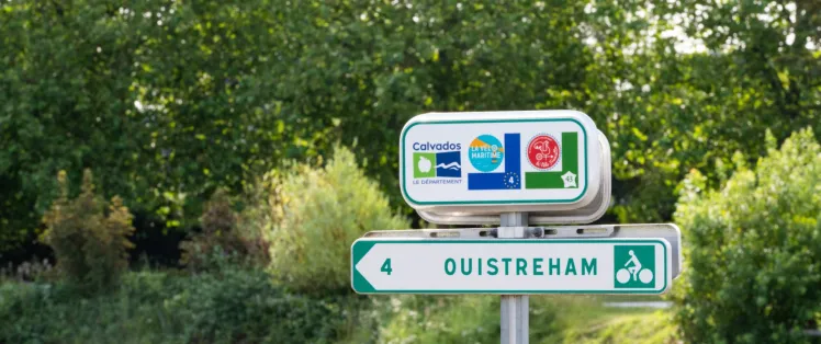
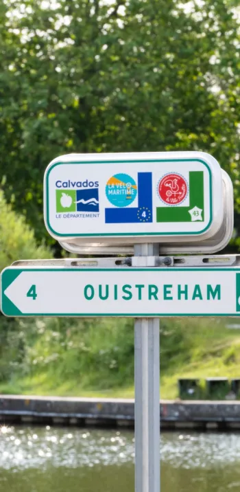
The national cycle routes presented on this site are specifically signposted. On your route, you will find dedicated signs with the route logo and a number corresponding to its national identifier. On your way you will find signposts with directions and in some cases mileage and connections nearby (places of interest, stations...).

Signposting of "EuroVelo" routes
The EuroVelo, European cycling cycle routes have additional signage. They are indicated by dark blue background signs indicating the EuroVelo number in the centre surrounded by the 12 stars of the European flag. In France, some of them are linked to national routes (La Vélodyssée, La Loire à Vélo,...), which is why you will also find the logo of the route that accompanies the EuroVelo number.

Signposting of mountain bike routes
The MTB routes are announced by an arrow overhanging two circles. This acronym exists in 3 different colours:
- Yellow for a local circuit,
- Red for a "Grande Traversée VTT" or a circuit of more than 80 km,
- Brown for a route through a Regional Natural Park.
The arrow can be tilted in 3 ways depending on the direction to be taken: if it is upwards, the route continues straight ahead; to the right, you have to take the right and left road... take the left road!
To this can be added a number under the sign indicating the number of the course with its difficulty (green, blue, red to black from the easiest to the most difficult) as well as, sometimes, precise indications on the name of the course (example "Grande Traversée du Massif Central").