Vue aérienne de la Vallée de la Vire à vélo
M. Lerouge
Coucher de soleil sur la plage de Cherbourg - Tour de Manche
M. Lerouge
Vue du Mont-St Michel au loin, à travers champ
CRT Bretagne - A. Lamoureux

Cycling the Manche coast from North to South

300km from the northern end of the Cotentin to Mont-Saint-Michel

On the Norman side, this itinerary runs through the department of Manche from North to South, wandering along the Vire valley in particular. Leaving Cherbourg and its port, pedal on a majority of green roads before seeing the marvel from its bay.

Vue aérienne de la Vallée de la Vire à vélo
M. Lerouge

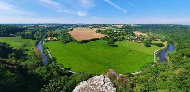
To the rhythm of the Vire Valley

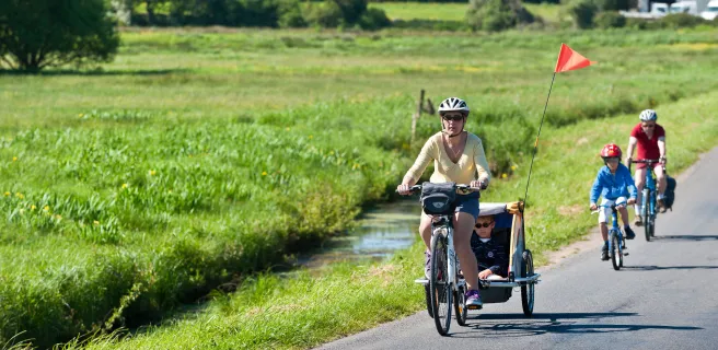
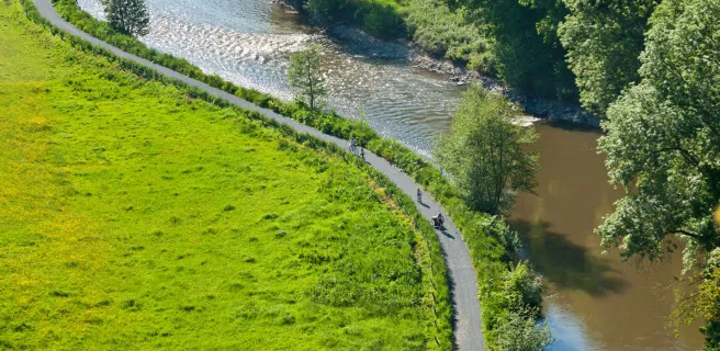
The Vire Valley, nestled in the Normandy countryside, is your playground and the thread linking Carentan and Vire, the town that shares its name with the river.

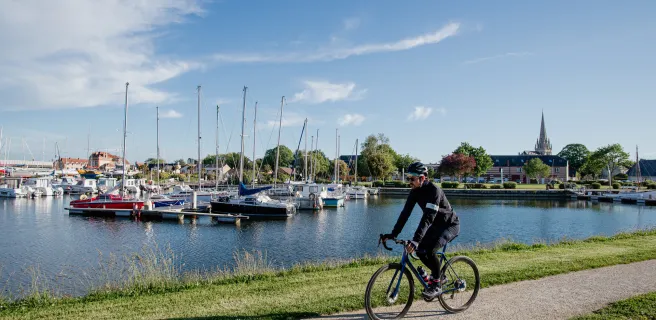
From glen to valley, whether channelled or wild, the Vire offers a nature getaway along the water’s edge. A towpath that attempts to follow its many meanders serves as a guiding thread, marked by the various river ports that dot its course.

Les cascades de Mortain
© J. Damase - La Véloscénie

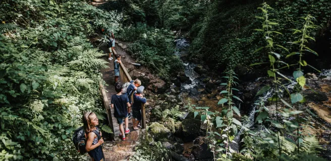
Recharge your batteries at the Mortain waterfalls

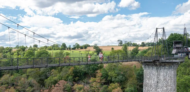
Perched on the hillside lies the village of Mortain, the green heart of the Normandy bocage, and a crossroads for the La Vélomaritime – EuroVelo 4 and La Véloscénie cycle routes.
In this lush natural setting, park your bikes for a short walk to the small waterfall. A series of wooden footbridges and steps will lead you to the main waterfall, which, with its 25-metre drop, will impress you with its flow and remarkable natural setting.
The best time to visit is in May or early June to enjoy the rhododendrons in bloom, which add an extra touch of charm to the place.

Découverte du Mont St-Michel en famille
CRT Bretagne - A. Lamoureux

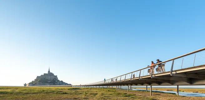
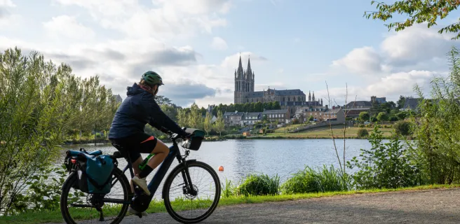
Exploring Mont St-Michel

The highlight of the trip, arriving at Mont-Saint-Michel by bike is a truly unique experience. Topped by an abbey that is a masterpiece of Gothic art, the islet faces the strongest tides in Europe. The bay of Mont-Saint-Michel alternates between open sea and rippled shore. A guided walk into the bay is available. 

Map of the cycle route

Map of the cycle route

Bricquebec-en-Cotentin / Cherbourg-en-Cotentin

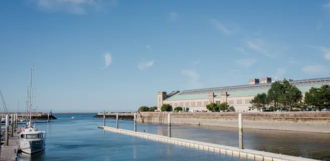
28 Bricquebec-en-Cotentin / Cherbourg-en-Cotentin

35 km
2 h 00 min
I begin
Leaving behind Bricquebec, you pedal along peaceful roads lined with farms and villages. You'll note the talus, high banks dividing up the meadows, fields and orchards, creating a typical Normandy landscape. Brix is your last stop before Cherbourg, with its ferry services to England and Ireland. At Cherbourg's port, a cycle path runs alongside one of the longest harbour walls in the world, dating as far back as 1783.
Saint-Sauveur-le-Vicomte / Bricquebec-en-Cotentin

27 Saint-Sauveur-le-Vicomte / Bricquebec-en-Cotentin

14 km
54 min
I begin
Going from Saint-Sauveur-le-Vicomte to Bricquebec and from one medieval château to another, you cycle peacefully along a safe, peaceful greenway, roughly at the pace of the former little train that used to run along the track here! You're crossing through a Pays d’Art et d’Histoire, Le Clos du Cotentin, a rich cultural area on the edge of the wetlands of the Marais du Cotentin and of the most important state forest in the county of Manche.
La Haye / Saint-Sauveur-le-Vicomte

26 La Haye / Saint-Sauveur-le-Vicomte

15 km
1 h 01 min
I begin
The Vélomaritime route leaves La Haye-du-Puits and its 11th-century keep, still defying time. This stage offers easy cycling along a green ribbon lined by trees, affording you lovely glimpses of the little valleys to the sides. Saint-Sauveur-le-Vicomte and its medieval château, which was besieged twice in the Hundred Years War, welcome you at the end of this stage.
Carentan-les-Marais / La Haye

25 Carentan-les-Marais / La Haye

22 km
1 h 27 min
I begin
You ride through the heart of the Parc Naturel Régional des Marais du Cotentin et du Bessin via a lovely greenway. Keep binoculars to hand, as the wetlands here are home to an exceptional variety of species of birds. During migration seasons, the spectacle of vast colonies of birds filling the skies is quite magical. Also make the most of the magnificent sunrises and sunsets over the marshes! You end the stage at La Haye-du-Puits, which, although it suffered major destruction during World War II, was lovingly restored and is now a lively, attractive village.
Saint-Jean-de-Daye / Carentan-les-Marais

24 Saint-Jean-de-Daye / Carentan-les-Marais

19 km
1 h 16 min
I begin
You leave behind the typical Normandy hedge-divided fields to enter wetlands boasting an impressive network of channels and canals. The Vélomaritime here also leads you into the heart of one of France's main horse-breeding areas. Keep your eyes peeled for signs indicating the way to local racecourses. Reaching Carentan, nestled in the Baie des Veys, its yachting harbour immediately takes you back to a coastal atmosphere on your cycling adventure.
Saint-Lô / Saint-Jean-de-Daye

23 Saint-Lô / Saint-Jean-de-Daye

23 km
1 h 30 min
I begin
The dynamic town of Saint-Lô, despite being heavily bombed in 1944 as World War II was reaching a climax in France, has preserved an exceptional heritage, notably the national stud farm, the Haras National, which you can visit, and the town's medieval ramparts. The Vélomaritime cycle route then continues beside the Vire Canal, meandering along up to St-Jean-de-Daye, through picture-postcard countryside.
Pont-Farcy / Saint-Lô

22 Pont-Farcy / Saint-Lô

32 km
2 h 06 min
I begin
5 / 5
Your cycling trip continues gently along the picture-postcard Vire towpath, with peaceful meadows where sheep and horses graze, wild hedges full of flowers in season, and enchanting villages, including lively little Tessy-sur-Vire. Along the way, don't miss the detour to Les Roches de Ham, providing spectacular views over the Vire Valley and the Pays Saint-Lois area. The Vire's waters long attracted numerous craftspeople, including weavers, tanners and washerwomen, while many barges, houseboats and gabarres, traditional boats, are still to be seen along this picturesque valley.
Vire Normandie / Pont-Farcy

21 Vire Normandie / Pont-Farcy

36 km
2 h 10 min
I cycle often
The Vire Valley acts as the thread along this Vélomaritime stage. After a stretch of greenway, you ride along minor roads through Normandy hedge-row-divided fields and valleys. With its ups and downs, this stage provides splendid views over the Vire's meanders and leads to La Ferrière-Harang, followed by the peaceful village of Pont-Farcy, nestled in a green corner beside the river. Highlight of the day is perhaps cycling under the grand Souleuvre Viaduct.
Mortain-Bocage / Vire Normandie

20 Mortain-Bocage / Vire Normandie

43 km
2 h 50 min
I begin
The sound of the largest waterfalls in northwest France still ringing in your ears, continue riding along a greenway through the hedge-divided fields of the Normandy bocage. Here, green dominates the scene and the typical Normandy countryside imparts a feeling of well-being. Once past Sourdeval, the Vélomaritime route leads on to Vire, a town rebuilt after the 1944 Allied bombings. The place has preserved its lively traditional market and is reputed for its culinary and craft heritage.
Saint-Hilaire-du-Harcouët / Mortain-Bocage

19 Saint-Hilaire-du-Harcouët / Mortain-Bocage

11 km
43 min
I begin
Leading you along slopes, this Vélomaritime stage guides you gently towards Mortain, at the green heart of Normandy's extensive area of typical hedge-divided fields, known as the bocage, and located where our route meets the Véloscénie cycle route. The greenway on this stage takes you close to the enchanting Cance waterfall. Do go and see it in its wild, steep setting, clearly showing how this part of Normandy is part of the wider Armorican granite peninsula.
Ducey-Les Chéris / Saint-Hilaire-du-Harcouët

18 Ducey-Les Chéris / Saint-Hilaire-du-Harcouët

19 km
1 h 15 min
I begin
This Vélomaritime stage shares the way with the Véloscénie cycle route, taking you along a former railway track converted into a greenway, leading to St-Hilaire du Harcouët. Founded and fortified by a comrade-in-arms to William the Conqueror, this fortress town strategically placed between the Cotentin Peninsula, Brittany and French Maine (now in the Pays de la Loire Region) offers a variety of activities in summer based around the Plans d'eau du Prieuré, a series of lakes.
Mont-Saint-Michel / Ducey-Les Chéris

17 Mont-Saint-Michel / Ducey-Les Chéris

22 km
2 h 03 min
I begin
The Vélomaritime route leaves Normandy's Marvel behind, taking you via minor roads across salt-meadows. Make the most of the last glimpses you're afforded across to the Mont Saint-Michel set in its great bay before reaching the Sélune Estuary, your gateway to the traditional bocage normand landscapes, consisting of hedge-divided fields. A lovely greenway leads you gently to the centre of the well-flowered village of Ducey.